


Up to this point our Winter has been fairly mild by Michigan standards but change is on the way. As we make the transition into February we'll be facing a reinforcement of arctic air and snow to remind us all there's still a lot of Winter left.
Return of the Cold & Snow
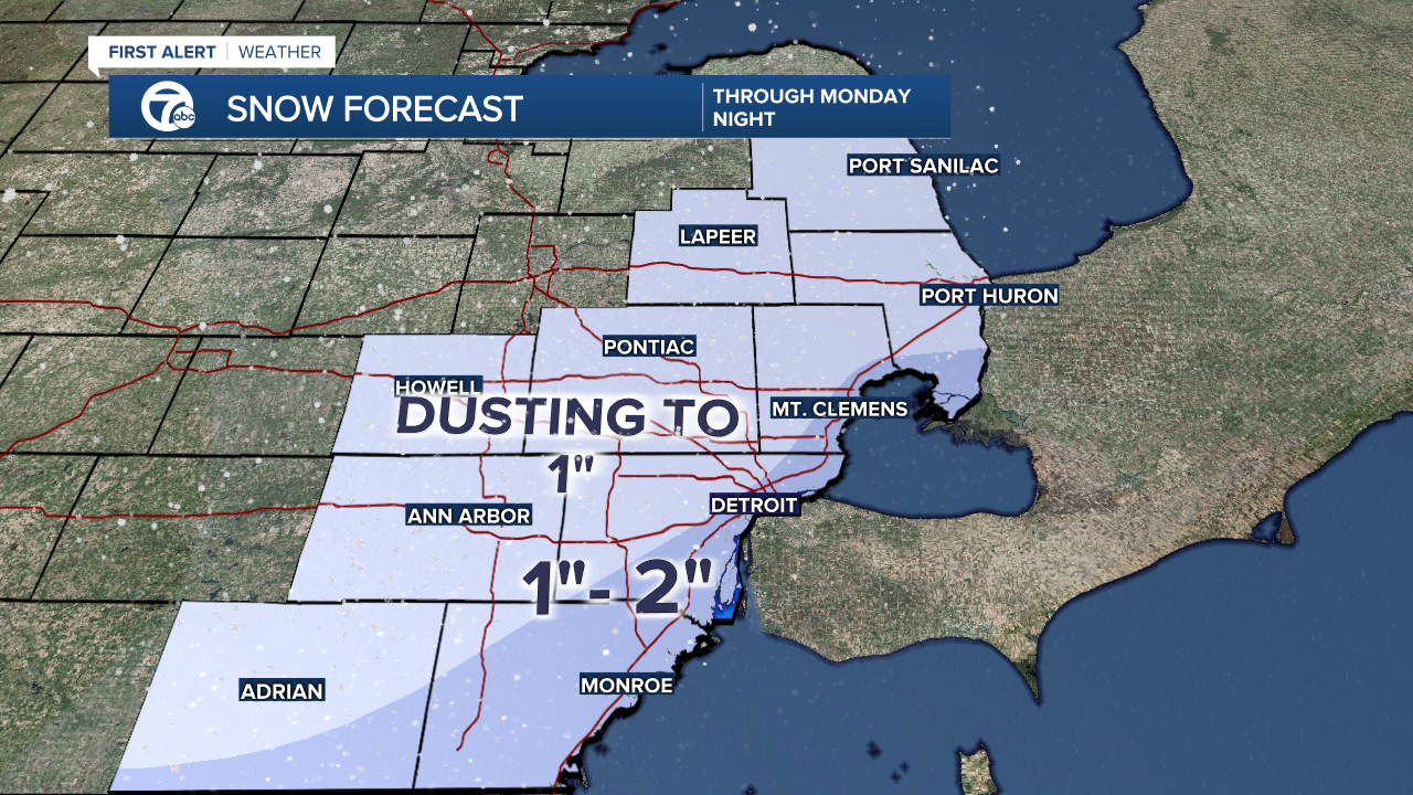
Snow showers will be lingering around to start the week where we could pick up an additional 1" - 2" in some areas of Metro Detroit. Most of this snow will fall during the day on Monday.
Once we are done with this system another one will be heading this way on Thursday bringing another round snow, which could mix with rain and sleet as well. We are still several days out but models have convincingly shown a storm heading towards the Great Lakes with an arctic air-mass right behind it. Even though "snow" and "storm" are buzzwords, I believe the arctic air behind this system will be the bigger story.

How Cold are we Talking?
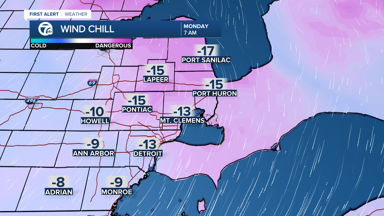
Cold enough to hear term "Polar Vortex" being thrown around again. Temps will be below average by roughly 10° - 15° placing highs in the low 20s and teens. Wind chills are another issue since portions of the Midwest and Great Lakes could see Wind Chill Advisories issued.
Detroit weather 7-day forecast
Connect with 7 First Alert Meteorologists on Facebook and Twitter:
Facebook: Dave Rexroth , Hally Vogel , Kevin Jeanes , Mike Taylor
Twitter: Dave Rexroth , Hally Vogel , Kevin Jeanes , Mike Taylor
