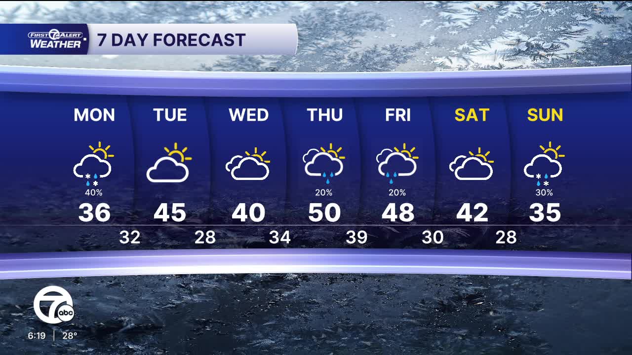


Clouds return Monday ahead of some light snow in the morning. There's a chance more snow, with a brief mix of sleet and rain as another batch returns during the evening. Accumulation will be less than 1/2" at best, but most of us will not have any accumulation. High temperatures peak in the mid 30s.
Highs climb into the low to mid 40s Tuesday and Wednesday under mostly cloudy skies.
Rain moves in overnight Wednesday and will wrap up by the early morning Thursday, Christmas Day. Another storm moves in later in the day bringing another round of rain showers into Thursday night. High temperatures will be well above average and near 50°.
Watch the full forecast in the video below
Tonight: Clouds increase. Lows in the upper teens, to near 20°. Winds: WSW 5-10 mph.
Monday: Mostly cloudy. Chance for snow, sleet, and rain. Highs in the mid 30s. Winds: S 5-10 mph.
Tuesday: Mostly cloudy with highs in the low to mid 40s. Winds: SW 10-20 mph.
Connect with 7 First Alert Meteorologists on Facebook and X:
Facebook: Dave Rexroth , Hally Vogel, Marisa Woloszyn, Mike Taylor
X: Dave Rexroth , Hally Vogel, Marisa Woloszyn, Mike Taylor
Current Conditions
- Humidity: 37%
- Dew point: 58°
- Pressure: 29.95 in
- Wind speed: 9 mph
- Wind direction: NW
- Visibility: 10.0 mi
- Sunrise: 06:23 AM
- Sunset: 08:54 PM
