

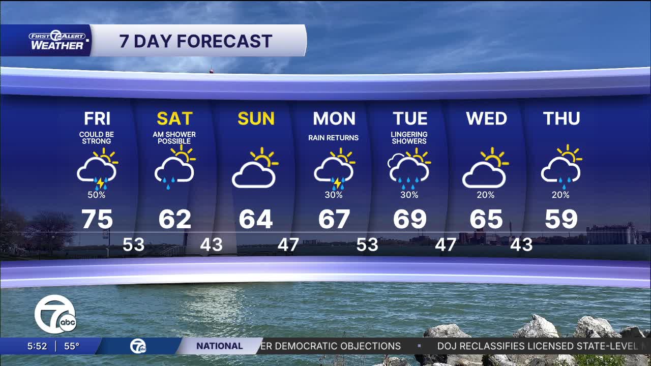


More widespread rain and storms are expected Friday with highs in the 70s again. The highest storm chance will come late in the day through the evening. If there is trouble, it will be from wind.
Watch the full forecast in the video player below:
Friday starts dry with a few breaks of sun and temperatures climbing quickly through the 50s and 60s during the morning. By late morning and the afternoon, clouds increase and highs topping out near 70 degrees for many neighborhoods. Late in the day and into the evening, scattered showers and thunderstorms become possible, especially after the commute. Keep an umbrella nearby if you have evening plans.
Rain chances return Monday with highs near 67, then a few lingering showers remain possible Tuesday and Wednesday with temperatures staying in the low to mid 60s. Overall, still mild for late April.
Friday: Increasing clouds with some showers and storms possible, mostly in the afternoon. Highs in the low to mid 70s. Winds: SE 10-20 mph.
Saturday: Clouds and a very slight rain chance early and then the clouds decrease. Much of the day will be dry. Highs in the low 60s. Winds: N 10-20 mph.
Connect with 7 First Alert Meteorologists on Facebook and X:
Facebook: Dave Rexroth , Hally Vogel, Marisa Woloszyn, Mike Taylor
X: Dave Rexroth , Hally Vogel, Marisa Woloszyn, Mike Taylor
Current Conditions
- Humidity: 52%
- Dew point: 60°
- Pressure: 29.96 in
- Wind speed: 7 mph
- Wind direction: NE
- Visibility: 10.0 mi
- Sunrise: 07:02 AM
- Sunset: 08:00 PM
