



Watch the forecast below
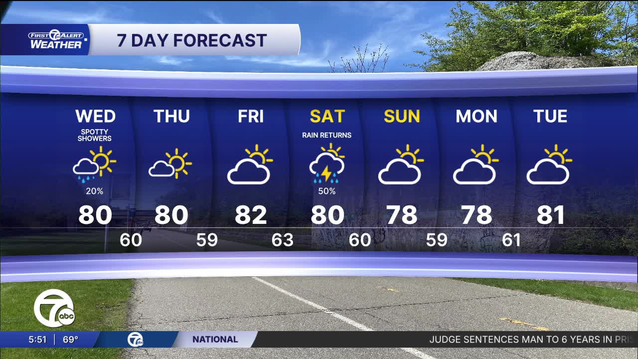
Rain and storms will be wrap up early Wednesday morning with lows in the mid to upper 60s. The rest of the day will mainly be partly sunny, but an isolated shower is possible in the late afternoon. Highs will be near 80°.
High pressure builds back in Thursday and brings mostly to partly sunny skies through Friday. High temperatures peak near 80° both days. Another chance for rain and storms arrives Saturday, especially for the afternoon and evening, and potentially continues into Sunday.
Tonight: Rain showers likely and some thunder is possible. The only area in any kind of severe threat is NW Livingston county. Lows in the mid 60s. Winds: WSW 5-10 mph.
Wednesday: Partly sunny with very small shower chances before 8 AM and after 4 PM. Highs near 80°. Winds: W 5-10 mph.
Thursday: Mostly sunny with highs near 80°.
Connect with 7 First Alert Meteorologists on Facebook and X:
Facebook: Dave Rexroth , Hally Vogel, Marisa Woloszyn, Mike Taylor
X: Dave Rexroth , Hally Vogel, Marisa Woloszyn, Mike Taylor
Current Conditions
- Humidity: 61%
- Dew point: 47°
- Pressure: 30.11 in
- Wind speed: 8 mph
- Wind direction: NW
- Visibility: 10.0 mi
- Sunrise: 07:31 AM
- Sunset: 07:12 PM
