

(WXYZ) — It will dry out overnight as skies clear. It will be a little cooler than normal this week as temps will hold mostly in the 70s for highs. The next rain chance is Tuesday.
YOUR FULL 7 FIRST ALERT FORECAST:
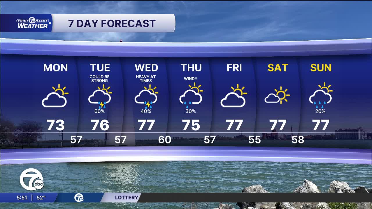
Next week starts off quiet Monday with partly sunny skies and highs in the mid 70s. Rain and storm chances increase again Tuesday afternoon and continue through Thursday. The higher storm chances will come Tuesday afternoon and evening and again Wednesday late through Wednesday night. The strongest storms are most likely Wednesday night with heavy rain expected. High temperatures remain just below average in the mid to upper 70s, with most of the overnight lows in the mid to upper 50s.
Tonight: Clouds decrease, cooler. Lows in the upper 40s to low 50s in Detroit. Winds: NW 5-15 mph.
Monday: It will be fairly bright in the morning and then clouds will build in the afternoon. Highs in the mid 70s. Winds: WNW 5-10 mph.
Connect with 7 First Alert Meteorologists on Facebook and X:
Facebook: Dave Rexroth , Hally Vogel, Marisa Woloszyn, Mike Taylor
X: Dave Rexroth , Hally Vogel, Marisa Woloszyn, Mike Taylor
Current Conditions
- Humidity: 37%
- Dew point: 50°
- Pressure: 29.9 in
- Wind speed: 11 mph
- Wind direction: NNW
- Visibility: 10.0 mi
- Sunrise: 06:22 AM
- Sunset: 08:56 PM
