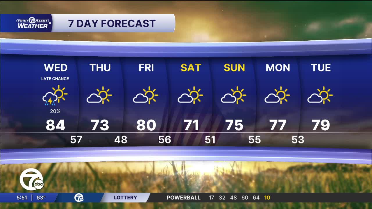


(WXYZ) — More warmth will be here Wednesday with highs in the low to mid 80s. There's a slight chance of a shower or thunderstorm Wednesday evening along a cold front. After that front temps fall into the 70s.
Temperatures fall to near 60° by Wednesday morning with partly cloudy skies from high clouds. There will be enough sun to get temperatures climbing into the low to mid 80s by the afternoon. A cold front will bring a chance for an isolated shower and even a thunderstorm Wednesday evening. Severe weather is not expected. Behind that cold front temps will cool a bit, but still be where they should be this time of year.
Temperatures drop for the rest of the week and into the weekend with highs in the low to mid 70s. Skies remain partly to mostly sunny. You may need to get the hoses out to keep the gardens growing with all of this dry weather.
Here's your Full Forecast:
Wednesday: Partly sunny with a very slight chance of an isolated shower or some thunder in the evening after 5 PM. Highs in the low to mid 80s with 84° in Detroit. Winds: NE 5-10 mph.
Thursday: Mostly sunny and dry with highs in the low 70s. Winds: NE 10-15 mph.
Connect with 7 First Alert Meteorologists on Facebook and X:
Facebook: Dave Rexroth , Hally Vogel, Marisa Woloszyn, Mike Taylor
X: Dave Rexroth , Hally Vogel, Marisa Woloszyn, Mike Taylor
Current Conditions
- Humidity: 87%
- Dew point: 72°
- Pressure: 29.95 in
- Wind speed: 3 mph
- Wind direction: S
- Visibility: 10.0 mi
- Sunrise: 05:59 AM
- Sunset: 09:14 PM
