

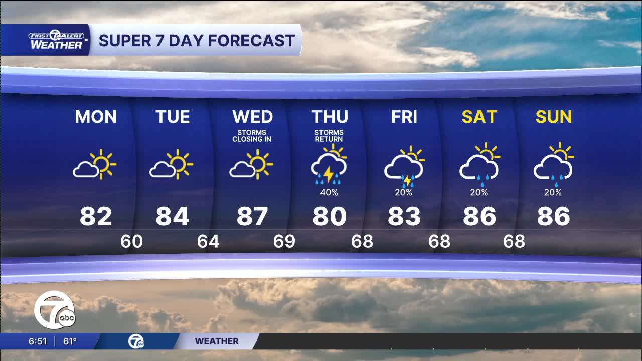


The workweek starts of dry with clearing skies Monday and highs near 80°. Sunshine continues Tuesday, with temperatures climbing into the low to mid 80s.
See the full forecast in the video below
We'll stay dry for most, if not all, Wednesday before rain returns late Wednesday into Thursday. This begins an unsettled weather pattern into the weekend with high temperatures in the mid 80s and lows in the mid 60s.
Tonight: Clearing skies and drying out. Lows in the mid 50s to near 60°. Winds: N 5-10 mph.
Monday: Mostly sunny with highs near 80°. Winds: N/NE 5-10 mph.
Tuesday: Mostly sunny with highs in the mid 80s.
Connect with 7 First Alert Meteorologists on Facebook and X:
Facebook: Dave Rexroth , Hally Vogel, Marisa Woloszyn, Mike Taylor
X: Dave Rexroth , Hally Vogel, Marisa Woloszyn, Mike Taylor
Current Conditions
- Humidity: 84%
- Dew point: 53°
- Pressure: 30.22 in
- Wind speed: 4 mph
- Wind direction: N
- Visibility: 10.0 mi
- Sunrise: 07:16 AM
- Sunset: 07:37 PM
