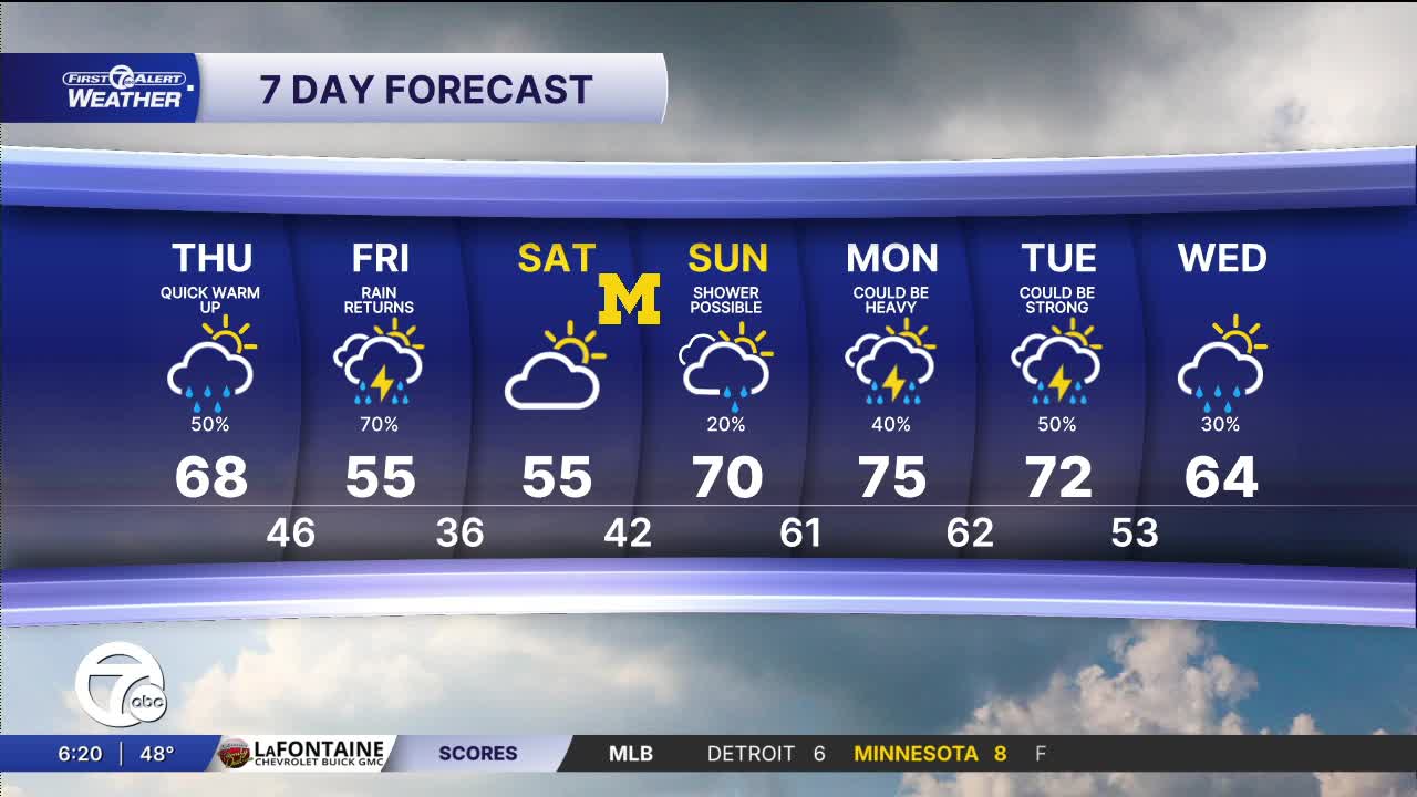


It is finally a little warmer and those milder temps will hang around into next week. The next rain chance is Thursday with one AM round and possibly a second in the afternoon. More rain Friday.
Watch the forecast below
It is significantly warmer today. Temperatures will continue to climb Thursday into the upper 60s. Skies will be partly sunny with a band of showers moving through. Showers continue Friday with highs in the mid 50s. There may be a little thunder as well, but no big storms are expected.
This weekend is split with rain and dry weather. Saturday will be dry with highs in the mid 50s, while Sunday will have a chance of showers and highs in the upper 60s to around 70°.
Tonight: Not as cold with lows in the mid to upper 40s. Clouds build as well. Winds: S 10-20 mph.
Thursday: Partly sunny with some passing showers. There should be more in the morning than the afternoon. Highs will reach the upper 60s and 68° in Detroit. Winds: SW 10-25 mph.
Friday: A cooler rain will be around in the morning. There may be a bit of sun in the afternoon. Highs will be in the low to mid 50s with 55° in Detroit. Winds: ENE 5-10 mph.
Connect with 7 First Alert Meteorologists on Facebook and X:
Facebook: Dave Rexroth , Hally Vogel, Marisa Woloszyn, Mike Taylor
X: Dave Rexroth , Hally Vogel, Marisa Woloszyn, Mike Taylor
Current Conditions
- Humidity: 87%
- Dew point: 72°
- Pressure: 29.96 in
- Wind speed: 3 mph
- Wind direction: S
- Visibility: 10.0 mi
- Sunrise: 05:59 AM
- Sunset: 09:14 PM
