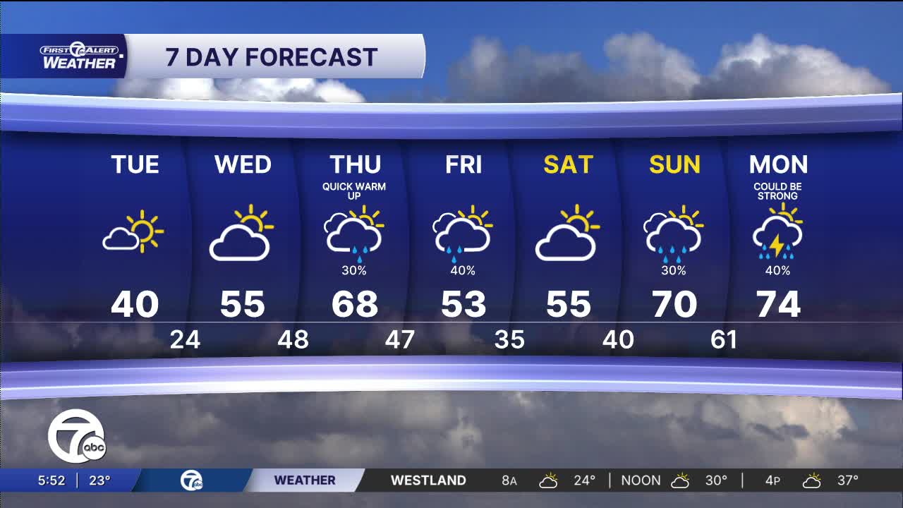


Tuesday starts off chilly with lows in the upper teens and low 20s. Highs gradually climb to near 40° by the afternoon with mostly sunny skies. Quite a few areas north of Detroit could get stuck in the upper 30s for highs.
Warmer air begins to return Wednesday afternoon with highs peaking in the low to mid 50s across southeast Michigan. It will be dry with partly sunny skies.
Temperatures continue to climb Thursday into the upper 60s, near 70°. Skies will be partly sunny for most of the day before rain showers move in by the evening. Showers continue Friday with highs in the mid 60s.
This weekend is split with rain and dry weather. Saturday will be dry with highs in the upper 50s, while Sunday will have showers and highs in the upper 60s.
Watch the full forecast in the video player below:
Tuesday: Mostly sunny. Highs in the upper 30s, near 40° in Detroit. Winds: N to E 5-10 mph.
Wednesday: Partly sunny. Highs in the low to mid 50s with 55° in Detroit. Winds: SE 10-20 mph.
Connect with 7 First Alert Meteorologists on Facebook and X:
Facebook: Dave Rexroth , Hally Vogel, Marisa Woloszyn, Mike Taylor
X: Dave Rexroth , Hally Vogel, Marisa Woloszyn, Mike Taylor
Current Conditions
- Humidity: 87%
- Dew point: 72°
- Pressure: 29.95 in
- Wind speed: 3 mph
- Wind direction: S
- Visibility: 10.0 mi
- Sunrise: 05:59 AM
- Sunset: 09:14 PM
