

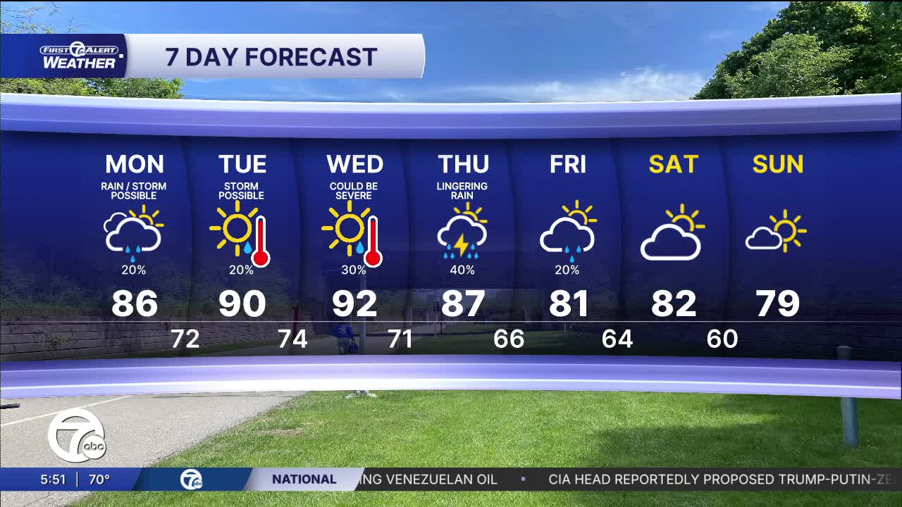


Isolated showers continue Sunday night as temperatures remain mild and in the upper 60s, near 70°. We should have a brief window of dry weather to start Monday, before showers return mid-morning and continue into the early afternoon. A few rumbles of thunder are possible, but severe weather is not expected. Skies will become mostly to partly sunny by the late afternoon as temperatures peak in the mid to upper 80s. Dew points will also be in the upper 60s and low 70s, keeping it muggy across the area.
Check out the forecast below:
The heat peaks Tuesday and Wednesday with highs near 90° both days. It's going to feel more like the mid 90s as dew points remain high. Showers in the afternoon/evening are expected both days. An additional shower and storm chance is expected Wednesday night into Thursday morning, with a marginal risk for severe thunderstorms. Keep an eye on the forecast as we approach midweek.
A few more shower are possible Thursday and Friday, but drier weather looks likely for Labor Day Weekend.
Tonight: Mostly cloudy with a few showers. Lows in the upper 60s, near 70°. Winds: SW 5 mph.
Monday: Mostly cloudy with a scattered showers midday. Clearing skies in the evening. Highs in the mid to upper 80s. Winds: SW 5-15 mph.
Tuesday: Partly sunny with a chance for showers and storms. Highs near 90°.
Connect with 7 First Alert Meteorologists on Facebook and X:
Facebook: Dave Rexroth , Hally Vogel, Marisa Woloszyn, Mike Taylor
X: Dave Rexroth , Hally Vogel, Marisa Woloszyn, Mike Taylor
Current Conditions
- Humidity: 70%
- Dew point: 61°
- Pressure: 29.8 in
- Wind speed: 8 mph
- Wind direction: SSW
- Visibility: 10.0 mi
- Sunrise: 07:42 AM
- Sunset: 06:55 PM
