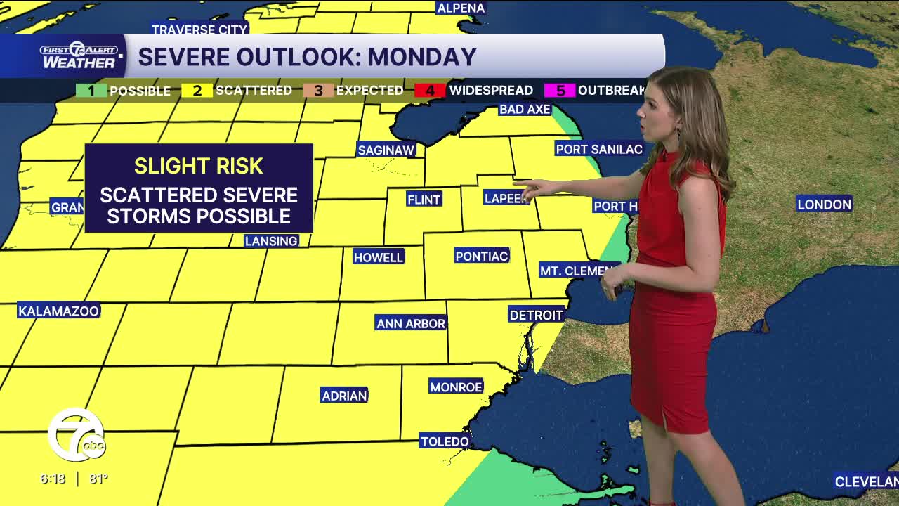


The heat continues Monday and Tuesday, with highs in the mid to upper 80s both days. Dew points will also be in the 60s, making it feel humid/sticky outside. In addition to the heat and humidity, severe storms will also be possible both days if the afternoon and evenings. Damaging wind gusts, 1" hail, and isolated tornadoes will be possible.
Relief from the heat and active weather comes midweek as temperatures drop back into the 60s.
Watch the full forecast in the video player below:
Tonight: Partly cloudy and warm. Lows in the low to mid 60s. Winds: S 5-10 mph.
Monday: Partly sunny, hot and muggy. Storms chances increase in the late afternoon and evening. A few could be strong to severe. Highs in the upper 80s, near 90°.
Connect with 7 First Alert Meteorologists on Facebook and X:
Facebook: Dave Rexroth , Hally Vogel, Marisa Woloszyn, Mike Taylor
X: Dave Rexroth , Hally Vogel, Marisa Woloszyn, Mike Taylor
Current Conditions
- Humidity: 87%
- Dew point: 72°
- Pressure: 29.95 in
- Wind speed: 3 mph
- Wind direction: S
- Visibility: 10.0 mi
- Sunrise: 05:59 AM
- Sunset: 09:14 PM
