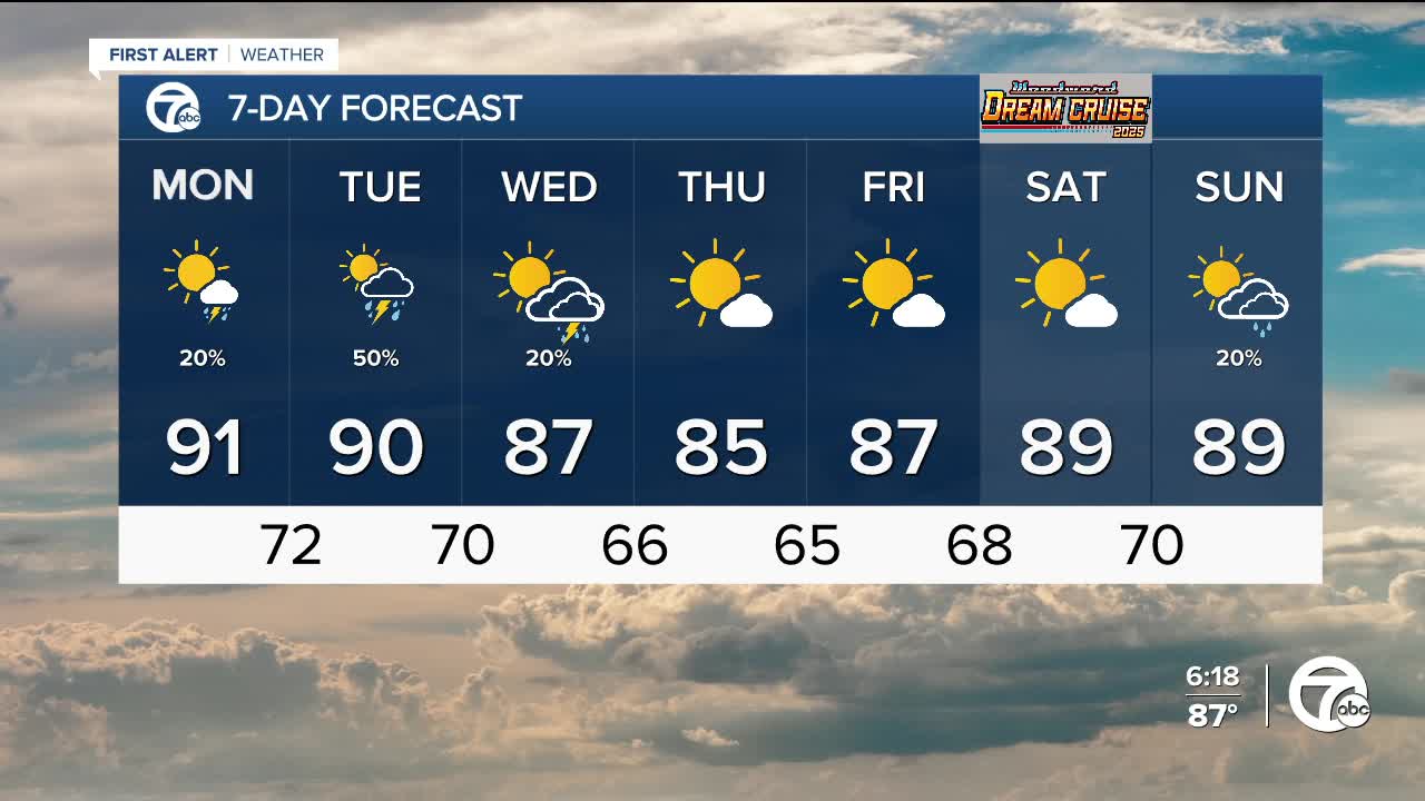


The workweek starts with hot and humid weather across Metro Detroit. Monday's highs will be near 90° with dew points near 70°. There is a chance for a few pop up showers and even a storm in the afternoon/evening. Heavy rainfall and localized flooding is possible.
A cold front to our northwest starts to move east Tuesday. Showers and storms will develop ahead of the front as early as Tuesday morning. Severe weather is not expected but heavy rainfall is possible. The cold front eventually moves through by Wednesday morning, with a slight chance for more showers and storms through the day. High temperatures will be near 90° Tuesday and in the upper 80s Wednesday. As you can see, the cold front does not provide much relief from the heat.
Mostly sunny skies return Thursday and Friday with highs in the mid to upper 80s. The sunshine sticks around as temperatures climb back into the upper 80s, to near 90°, for the Woodward Dream Cruise Saturday.
Tonight: Mostly clear with lows near 70°. Winds: S 5-10 mph.
Monday: Mostly sunny with highs near 90°. Afternoon showers and a thunderstorm possible. Winds: SW 5-10 mph.
Tuesday: Partly sunny with showers and thunderstorms likely. Highs near 90°. Winds: SW 5-15 mph.
Current Conditions
- Humidity: 89%
- Dew point: 57°
- Pressure: 29.96 in
- Wind speed: 3 mph
- Wind direction: WNW
- Visibility: 10.0 mi
- Sunrise: 05:57 AM
- Sunset: 09:14 PM
