

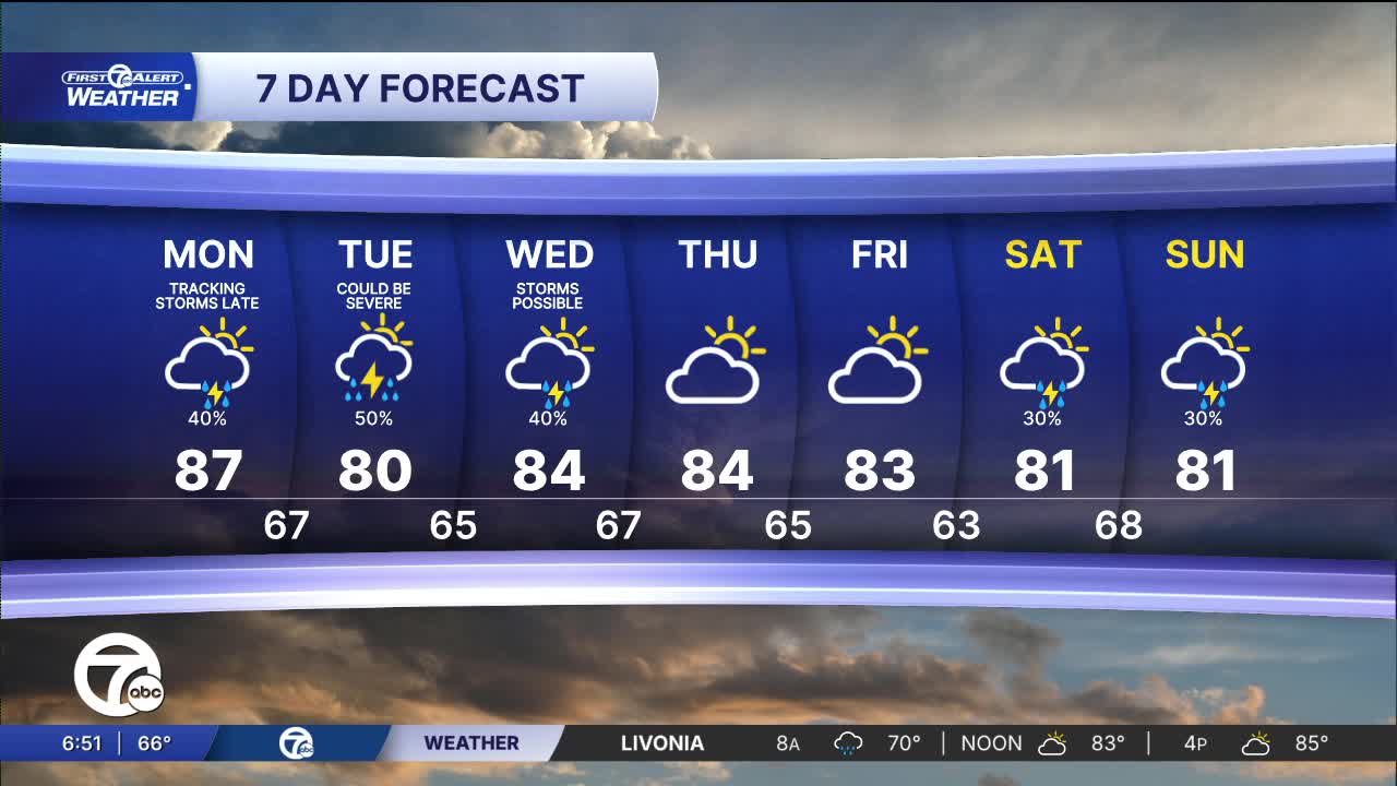


An unsettled weather pattern continues through the first half of this week. Strong to severe storms are possible both Monday and Tuesday, but there is also a chance storms stay to our south. The location of storms will be highly depending on where a front develops across the region. Storms will be more likely to ride along the front or just to its south where the environment is more unstable. For now, keep an eye on the forecast and be prepared for the potential severe weather, but know that there is a chance southeast Michigan doesn't see any.
Check out the forecast:
A few more showers and storm continue into Wednesday, before partly sunny skies return for Thursday and Friday. High temperatures will be in the low to mid 80s through the entire week, with lows near 70° early and falling into the low to mid 60s by the end.
Monday: Partly sunny. Strong to severe storms possible late. Highs in the mid 80s.
Tuesday: Partly sunny. Strong to severe storms possible late. Highs in the mid 80s.
Connect with 7 First Alert Meteorologists on Facebook and X:
Facebook: Dave Rexroth , Hally Vogel, Marisa Woloszyn, Mike Taylor
X: Dave Rexroth , Hally Vogel, Marisa Woloszyn, Mike Taylor
Current Conditions
- Humidity: 90%
- Dew point: 49°
- Pressure: 30.38 in
- Wind speed: 5 mph
- Wind direction: NNE
- Visibility: 10.0 mi
- Sunrise: 07:22 AM
- Sunset: 07:26 PM
