

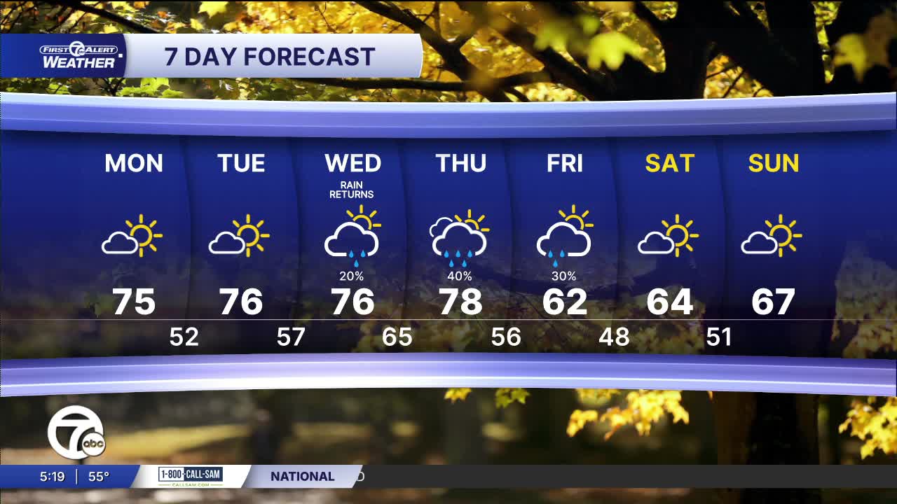


Monday starts with a fall chill across Metro Detroit, with temperatures in the mid-50s for the trip to work and school. Sunshine takes over quickly, warming us into the low 60s by 10 a.m. and near 70° at lunchtime. By late afternoon, expect the mid-70s and plenty of sun.
Detroit reaches about 75° today after that cool start. Most of the area lands in the low to mid-70s, though Port Huron and Port Sanilac stay closer to 70°. A north wind at 5–10 mph keeps the day comfortable, with a few more clouds possible later in the afternoon.
Mostly clear skies bring the fall chill back tonight. Detroit drops to around 52°, with many suburbs falling into the 40s. Lapeer could dip to 43°, so you may want a jacket for Tuesday morning.
Tuesday brings another sunny day. We’ll start near 53° at 8 a.m., climb through the 60s by late morning and reach about 74° during the afternoon.
The warmer pattern holds into midweek, with highs near 76° Wednesday and 78° Thursday. Shower chances rise from 20% Wednesday to 40% Thursday. A few showers remain possible Friday as temperatures drop sharply to around 62°, then the weekend looks partly sunny with highs in the mid-60s.
Today: Patchy fog, then sunny. Highs in the mid 70s. Wind: N 5-10 mph.
Tonight: Mostly clear. Lows in the upper 40s low 50s. Winds: N 5 mph.
Tuesday: Patchy fog, then mostly sunny. Highs in the mid 70s. Winds: Light.
Connect with 7 First Alert Meteorologists on Facebook and X:
Facebook: Dave Rexroth , Hally Vogel, Marisa Woloszyn, Mike Taylor
X: Dave Rexroth , Hally Vogel, Marisa Woloszyn, Mike Taylor
Current Conditions
- Humidity: 93%
- Dew point: 51°
- Pressure: 30.04 in
- Wind speed: 5 mph
- Wind direction: NNW
- Visibility: 9.0 mi
- Sunrise: 07:27 AM
- Sunset: 07:19 PM
