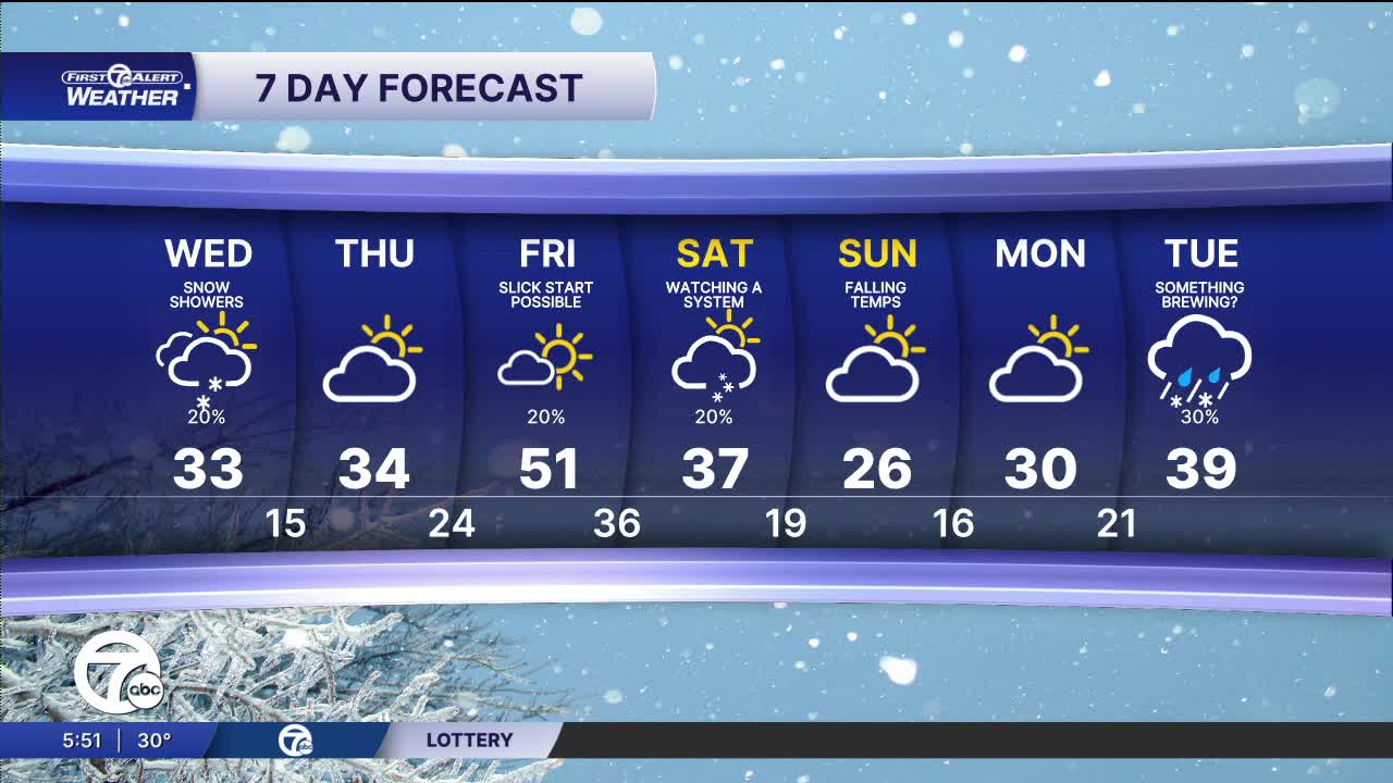


Travel conditions for the Wednesday morning commute should be pretty good on the main roads and any roads that have been salted. A few snow showers could linger Wednesday morning with highs in the low to mid 30s.
There may be two more batches of snow this weekend on Saturday night and Sunday night. It's hard to tell how much for wither of these, but they don't look to be big storms right now.
Watch the forecast below
The rest of the week settles into a fairly quiet late-February pattern. Thursday looks mostly cloudy with highs in the low to mid 30s. A milder push of air arrives Friday with highs climbing into the upper 40s. After the quick spike, temperatures fall quickly back into the 30s by Saturday afternoon. Saturday night into Sunday colder air moves back in.
Tuesday Night: Snow showers end early and then it will be mostly cloudy. Lows in the upper 20s. Winds: SW-W 10-20 mph.
Wednesday: A few snow showers are possible in the morning. A few bits of sun are possible. Highs in the mid 30s. Winds: W 15-25 mph.
Thursday: Partly sunny with highs in the low to mid 30s. Winds: SW 5-10 mph.
Connect with 7 First Alert Meteorologists on Facebook and X:
Facebook: Dave Rexroth , Hally Vogel, Marisa Woloszyn, Mike Taylor
X: Dave Rexroth , Hally Vogel, Marisa Woloszyn, Mike Taylor
Current Conditions
- Humidity: 41%
- Dew point: 59°
- Pressure: 29.97 in
- Wind speed: 10 mph
- Wind direction: NNW
- Visibility: 10.0 mi
- Sunrise: 06:23 AM
- Sunset: 08:54 PM
