

Mostly clear north overnight and partly cloudy south. The rain is over. Temps will drop into the upper 40s. The sun is back Thursday with increasing rain and storm chances Friday.
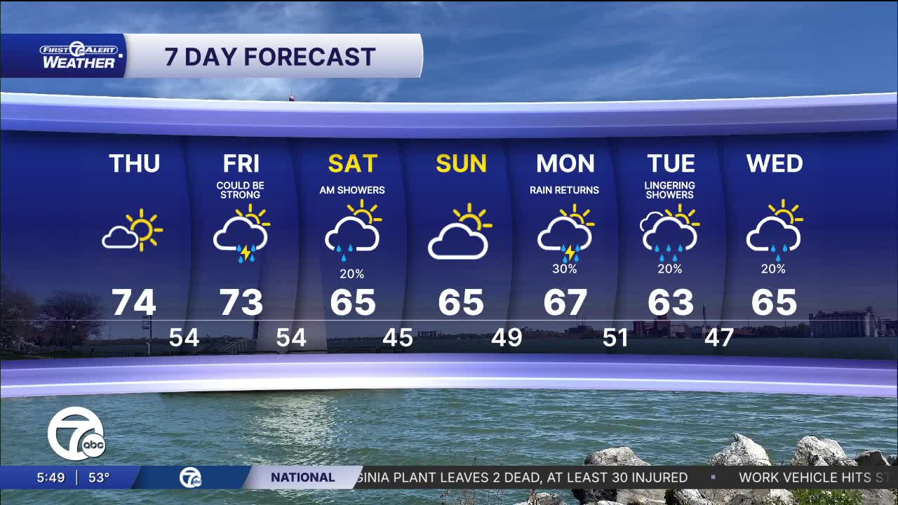
It will be nice and bright again Thursday with more highs in the 70s. The coolest areas will be on the east side of Metro Detroit because of a southeast wind off of the lakes. Even in these somewhat cooler areas we can still get to the low 70s. It will be mid to even upper 70s as you get west of I-275.
Friday stays warm, but it also brings the next chance for active weather. Scattered showers and thunderstorms are possible as a system moves through. It won’t be a washout all day, but you’ll want to keep an eye on the forecast if you have afternoon or evening plans.
A cool down follows for the weekend. Highs drop into the low to mid 60s, with partly sunny skies both days.
Watch the forecast below
Tonight: Clear to partly cloudy overnight with lows in the upper 40s. Winds: Variable 5 mph.
Thursday: Partly sunny with highs in the low to mid 70s. Winds: SSE 5-10 mph.
Friday: Increasing clouds with some showers and storms possible, mostly in the afternoon. Highs in the low to mid 70s. Winds: SE 1-150 mph.
Connect with 7 First Alert Meteorologists on Facebook and X:
Facebook: Dave Rexroth , Hally Vogel, Marisa Woloszyn, Mike Taylor
X: Dave Rexroth , Hally Vogel, Marisa Woloszyn, Mike Taylor
Current Conditions
- Humidity: 87%
- Dew point: 72°
- Pressure: 29.95 in
- Wind speed: 3 mph
- Wind direction: S
- Visibility: 10.0 mi
- Sunrise: 05:59 AM
- Sunset: 09:14 PM
