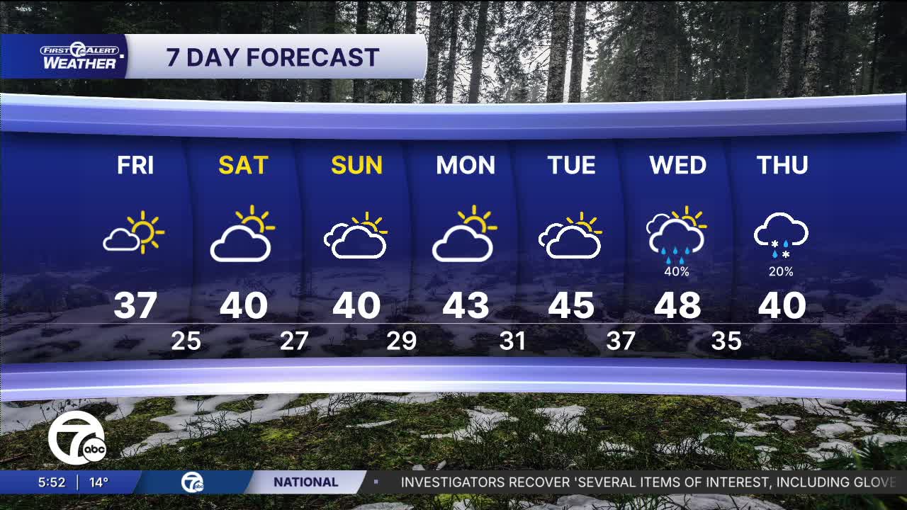


After a chilly morning start Friday a thaw that takes us into the weekend. 40s are expected for a couple of days starting Saturday. Next week should stay mid through Wednesday.
Early next week continues the mild push for February standards — Monday reaches the low 40s and Tuesday pushes into the mid 40s with mostly cloudy skies. By midweek, we’re looking at the warmest stretch near the upper 40s, though a chance of showers Tuesday night and Wednesday develops as the milder air settles in. It is still February and we are not done with Winter yet. There could be some flakes mixed in with rain showers at temps drop again on Thursday.
See the full forecast in the video below
Friday: Partly to mostly sunny with highs in the upper 30s. A few spots around US23 may get to the low 40s. Winds: SW 5-15 mph.
Saturday: Morning sun followed by some high clouds in the afternoon. Highs will be around 40°. Winds: WSW 5 mph.
Connect with 7 First Alert Meteorologists on Facebook and X:
Facebook: Dave Rexroth , Hally Vogel, Marisa Woloszyn, Mike Taylor
X: Dave Rexroth , Hally Vogel, Marisa Woloszyn, Mike Taylor
Current Conditions
- Humidity: 39%
- Dew point: 59°
- Pressure: 29.96 in
- Wind speed: 11 mph
- Wind direction: NNW
- Visibility: 10.0 mi
- Sunrise: 06:23 AM
- Sunset: 08:54 PM
