

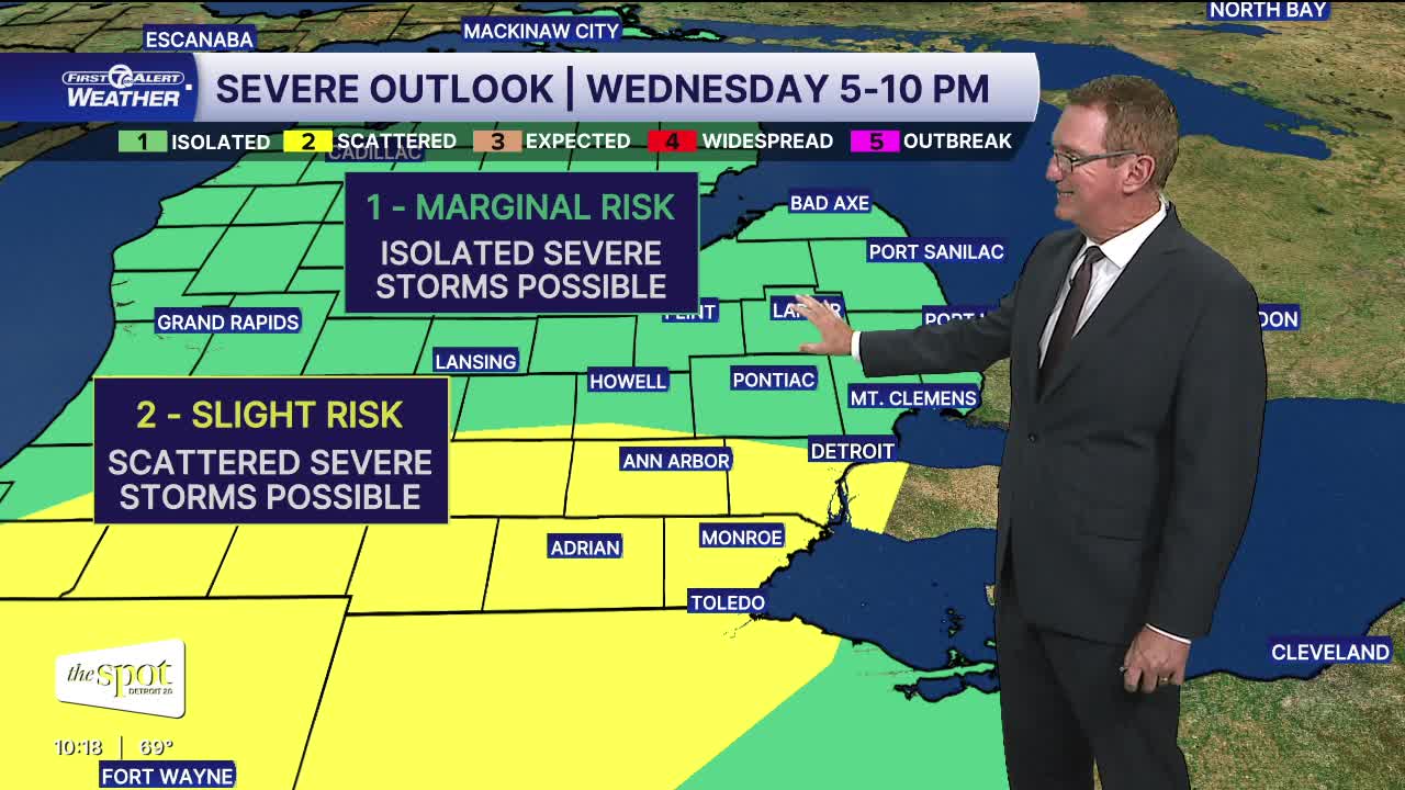


Clear skies continue into Wednesday morning with plenty of sunshine to start. Clouds increase during the afternoon as temperatures warm into the low 80s. Dew point will also be higher and into the mid 60s by the afternoon.
A cold front will bring the chance for strong to severe storms late Wednesday, mainly between 5-10 mph. All severe weather threats are possible including isolated tornadoes, 1" hail, 60 mph damaging wind gusts, and minimal flooding. Be prepared to seek shelter in basement or interior room if a tornado warning or severe thunderstorm warning is issued for your area.
Watch the forecast video below:
Thursday will be partly sunny with a few showers or an isolated storm in the afternoon. Severe weather is not expected. Highs climb into the low 80s.
Friday and Saturday will be dry and pleasant, with highs near 80°. Temperatures climb again late in the weekend, reaching the mid to upper 80s Sunday through Tuesday.
Tonight: Mostly clear with lows of 61° in Detroit and mid to upper 50s outside the city. Winds: SSW 5 mph.
Wednesday: Partly sunny with an increasing storm chance in the afternoon. Strong to severe storms are possible late in the day. Highs will be in the low 80s. Winds: SSW 5-15 mph.
Thursday: Partly sunny with a slight afternoon shower or storm chance. Highs in the low 80s.
Connect with 7 First Alert Meteorologists on Facebook and X:
Facebook: Dave Rexroth , Hally Vogel, Marisa Woloszyn, Mike Taylor
X: Dave Rexroth , Hally Vogel, Marisa Woloszyn, Mike Taylor
Current Conditions
- Humidity: 59%
- Dew point: 44°
- Pressure: 30.22 in
- Wind speed: 2 mph
- Wind direction: ENE
- Visibility: 10.0 mi
- Sunrise: 07:39 AM
- Sunset: 07:00 PM
