

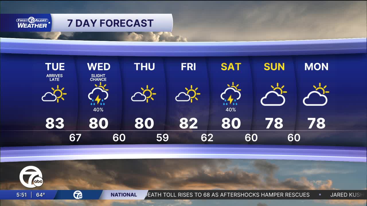


Check out the forecast:
Tuesday starts off sunny before clouds increase late in the afternoon. A few showers are possible in in the early evening, but mainly up towards the tip of the thumb. A better chance for rain and isolated storms comes Tuesday night as a cold front moves across the area. Severe weather is not expected. Temperatures fall into the low to mid 60s by Wednesday morning.
Isolated showers and storms continue Wednesday morning, with a few more possible in the afternoon, especially late. Skies will otherwise be partly sunny with highs near 80°.
High pressure builds back in Thursday and brings mostly sunny skies through Friday. High temperatures peak near 80° both days.
Another chance for rain and storms arrives Saturday and potentially continues into Sunday.
Tonight: Mostly clear north and a few clouds south with lows in the mid 50s to low 60s. Winds: Light.
Tuesday: Mostly sunny with some extra clouds late in the day. Rain chance starts late in the day or in the evening. The higher chances are north of M-59. Highs near 80°. Winds: SW 5-10 mph.
Wednesday: Isolated showers and storms. The best chances are early and late. Highs near 80°. Winds: W 5-10 mph.
Connect with 7 First Alert Meteorologists on Facebook and X:
Facebook: Dave Rexroth , Hally Vogel, Marisa Woloszyn, Mike Taylor
X: Dave Rexroth , Hally Vogel, Marisa Woloszyn, Mike Taylor
Current Conditions
- Humidity: 37%
- Dew point: 44°
- Pressure: 30.14 in
- Wind speed: 7 mph
- Wind direction: N
- Visibility: 10.0 mi
- Sunrise: 07:24 AM
- Sunset: 07:23 PM
