


No frost or freeze advisories overnight into Tuesday morning. The rest of the week will be much warmer with highs in the 60s and 70s. There could be a sprinkle early Tuesday and a shower late
Temperatures climb through the rest of the week, with highs in the upper 60s to mid 70s through the weekend.
Rain showers and a thunderstorm are possible late Tuesday and Tuesday evening. Otherwise, we stay dry until Friday when showers and storms become more likely through the day.
Check out the forecast below:
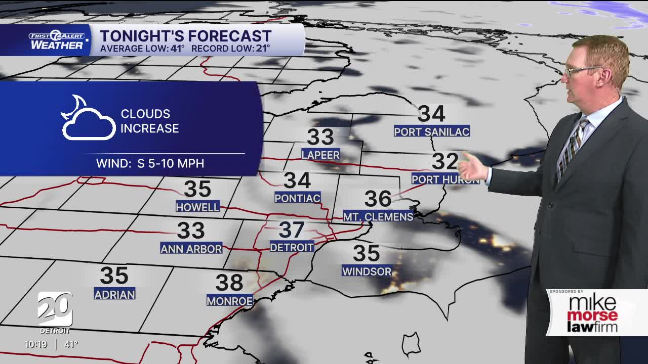
Tonight: Clouds increase. Lows in the mid 30s. Winds: S 5-10 mph.
Tuesday: Partly sunny. There could be a sprinkle in the morning and a thundershower in the evening. Much of the day is dry. Highs in the upper 60s to low 70s. Winds: SW 15-25 mph.
Wednesday: Mostly sunny with highs in the upper 60s to around 70°. Winds: N 5 mph.
Connect with 7 First Alert Meteorologists on Facebook and X:
Facebook: Dave Rexroth , Hally Vogel, Marisa Woloszyn, Mike Taylor
X: Dave Rexroth , Hally Vogel, Marisa Woloszyn, Mike Taylor
Current Conditions
- Humidity: 88%
- Dew point: 64°
- Pressure: 29.69 in
- Wind speed: 10 mph
- Wind direction: NW
- Visibility: 9.0 mi
- Sunrise: 06:14 AM
- Sunset: 09:03 PM
