

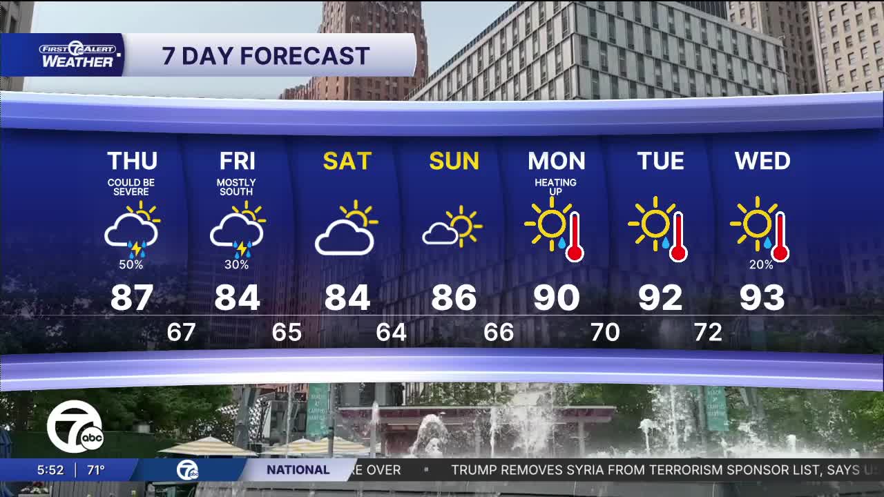


Thursday storms return to the area and some of them could be severe, especially from 2PM to 8PM. If we have any problems, it will be with wind.
Watch the full forecast in the video player below:
Thursday starts off with some sunshine, but clouds will gradually increase through the afternoon. We’ll once again climb into the mid-80s before scattered showers and thunderstorms become more likely later in the day and through the evening commute. Not everyone will see rain, but you’ll want to keep an eye on the forecast if you have outdoor plans.
While widespread severe weather isn’t expected, there is a Level 1 out of 5 risk for isolated severe thunderstorms Thursday afternoon and evening. Any storm that develops could produce gusty winds, heavy downpours, and frequent lightning. The severe threat is low, but it’s worth staying weather-aware as we head through the second half of the day and the evening. The most likely time for storms is 2 PM to 8PM.
Looking ahead, temperatures remain seasonably warm through the weekend with highs mainly in the mid to upper 80s. Rain chances stay fairly limited after Thursday, giving us a pleasant stretch for Saturday and Sunday. Then the heat begins to build early next week, with highs pushing 90 on Monday and into the lower 90s Tuesday and Wednesday.
Tonight: Mostly clear with a slight rain chance north of I-69 in the thumb. Lows will be in the mid to upper 60s with 70° in Detroit. Winds: SW 5 mph.
Thursday: Partly sunny with an increasing shower and storm chance. The best chance of storms will be 2 PM to 8 PM. An isolated storm could have damaging wind. Highs: in the mid 80s including 87° in Detroit. Winds: WSW 5-15 mph.
Friday: Partly sunny with a 30% chance of rain and storms. Most chances will be south of M-59. Highs will be in the mid 80s. Winds: N 5 mph.
Connect with 7 First Alert Meteorologists on Facebook and X:
Facebook: Dave Rexroth , Hally Vogel, Marisa Woloszyn, Mike Taylor
X: Dave Rexroth , Hally Vogel, Marisa Woloszyn, Mike Taylor
Current Conditions
- Humidity: 49%
- Dew point: 52°
- Pressure: 29.74 in
- Wind speed: 9 mph
- Wind direction: SW
- Visibility: 10.0 mi
- Sunrise: 07:37 AM
- Sunset: 07:03 PM
