

Tuesday afternoon through Tuesday night we should get more storms. Some could be severe.
It will stay warm and sticky overnight with temperatures fall into the mid to upper 60s by Tuesday morning. The skies will be partly cloudy.
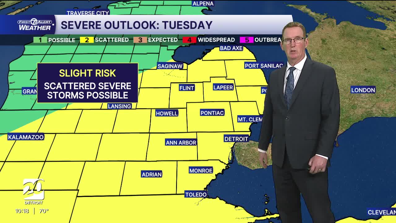
Tuesday will be another hot and humid day with high temperatures in the mid to upper 80s. Strong to severe thunderstorms are possible again during the afternoon/evening. These storms will be ahead and along a cold front. That is a different kind of organized storm than what we had today, but the severe threats are still in play, espcially after 5 PM. The storm threat should last into the overnight as well.
This next cold front is a strong one! Cooler and calmer weather is expected for the second half of the workweek with high temperatures will be in the mid to upper 60s and lots of lows in the mid 40s. The next rain chance after tomorrow and tomorrow night will come on Friday with possible showers.
Watch the forecast below
Tonight: Mostly cloudy skies with lows near 68°. There is a slight shower chance. Winds: SSW 10 - 20 mph.
Tuesday: Hot and humid again with highs near 87°. There could be a few showers in the morning, but storms will push through during the afternoon and could be strong to severe lasting through the evening. Winds: SSW 15-25 mph
Wednesday: Much cooler with partly to mostly sunny skies and highs in the mid 60s. NNW winds will blow around 10 mph.
Connect with 7 First Alert Meteorologists on Facebook and X:
Facebook: Dave Rexroth , Hally Vogel, Marisa Woloszyn, Mike Taylor
X: Dave Rexroth , Hally Vogel, Marisa Woloszyn, Mike Taylor
Current Conditions
- Humidity: 89%
- Dew point: 72°
- Pressure: 29.95 in
- Wind speed: 4 mph
- Wind direction: S
- Visibility: 10.0 mi
- Sunrise: 05:59 AM
- Sunset: 09:14 PM
