

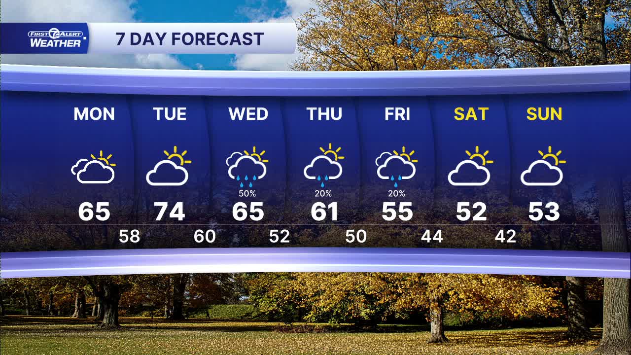


Warm weather continues into the workweek with increasing chances of rain. Today starts off with clouds and temps near 50° in the morning, then climbing into the mid 60s by the afternoon.
A few sprinkles can not be ruled out, especially late in the day. The sprinkles are ahead of a warm front that will clip the area Monday night. Most, if not all, of southeast Michigan will miss out on widespread rain with the front.
Tuesday will be much warmer with south-southwesterly winds 10-20 mph pulling in warmer air. High temperatures climb into the low to mid 70s with partly sunny skies.
A cold front slowly move through Wednesday and brings scattered rain showers across the area. High temperatures will be slight cooler and in the mid to upper 60s.
A few showers will linger into Thursday and Friday as the storm system moves to the east. High temperatures also begin to slide with highs closer to 60°.
Today: Mostly cloudy with a few sprinkles. Temps in the mid 60s. Winds: S 5 mph.
Tonight: Mostly cloudy. Temps in the mid to upper 50s. Winds: S 5-10 mph.
Tuesday: Partly sunny. Highs in the low to mid 70s. Winds: SSW 10-20 mph.
Connect with 7 First Alert Meteorologists on Facebook and X:
Facebook: Dave Rexroth , Hally Vogel, Marisa Woloszyn, Mike Taylor
X: Dave Rexroth , Hally Vogel, Marisa Woloszyn, Mike Taylor
Current Conditions
- Humidity: 87%
- Dew point: 48°
- Pressure: 30.27 in
- Wind speed: 3 mph
- Wind direction: S
- Visibility: 10.0 mi
- Sunrise: 07:07 AM
- Sunset: 05:24 PM
