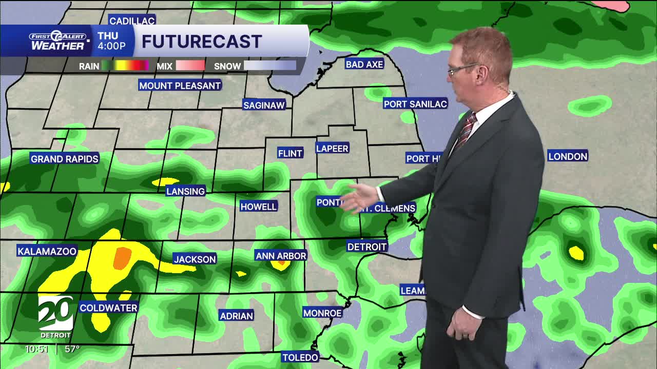


Highs Thursday will be in the mid to upper 60s around the Metro Detroit area and south. This will add extra energy to storms if they get going in the afternoon. Rain/storm chances increase after 3 PM.
Watch the forecast below
Rain and storms chances return Thursday. Strong storms are possible Thursday evening south of M59. The highest chance for a severe storm will come around and after 6 PM until 10 PM. Most of these, if we get them, will be around and south of I-94. All threats, a tornado, large hail, damaging wind, and flooding, are possible.
Cooler air quickly follows Friday, dropping highs back to around 40° or a little cooler north of the city. Temperatures then rebound through the weekend, with highs in the mid 40s Saturday, mid 50s Sunday, and mid 60s by Monday under a mix of clouds and some sunshine.
Tonight: Partly to mostly cloudy skies with milder temps in the mid to upper 40s. Winds: SW 5-15 mph
Thursday: Mostly cloudy with rain chances increasing in the afternoon. Storms are possible after 3 PM and through the evening. An isolated storm could become severe. The highest chance for this is around and south of I-94 after 5 PM. Highs will be in the mid to upper 60s with 67° in Detroit. Winds: SW 10-20 mph.
Friday: Much cooler with a chilly breeze. There will be some sun, but it won't help too much. Highs will be around 40° in Detroit and a little cooler north of the city. Winds: N 10-20 mph.
Connect with 7 First Alert Meteorologists on Facebook and X:
Facebook: Dave Rexroth , Hally Vogel, Marisa Woloszyn, Mike Taylor
X: Dave Rexroth , Hally Vogel, Marisa Woloszyn, Mike Taylor
Current Conditions
- Humidity: 41%
- Dew point: 59°
- Pressure: 29.97 in
- Wind speed: 10 mph
- Wind direction: NNW
- Visibility: 10.0 mi
- Sunrise: 06:23 AM
- Sunset: 08:54 PM
