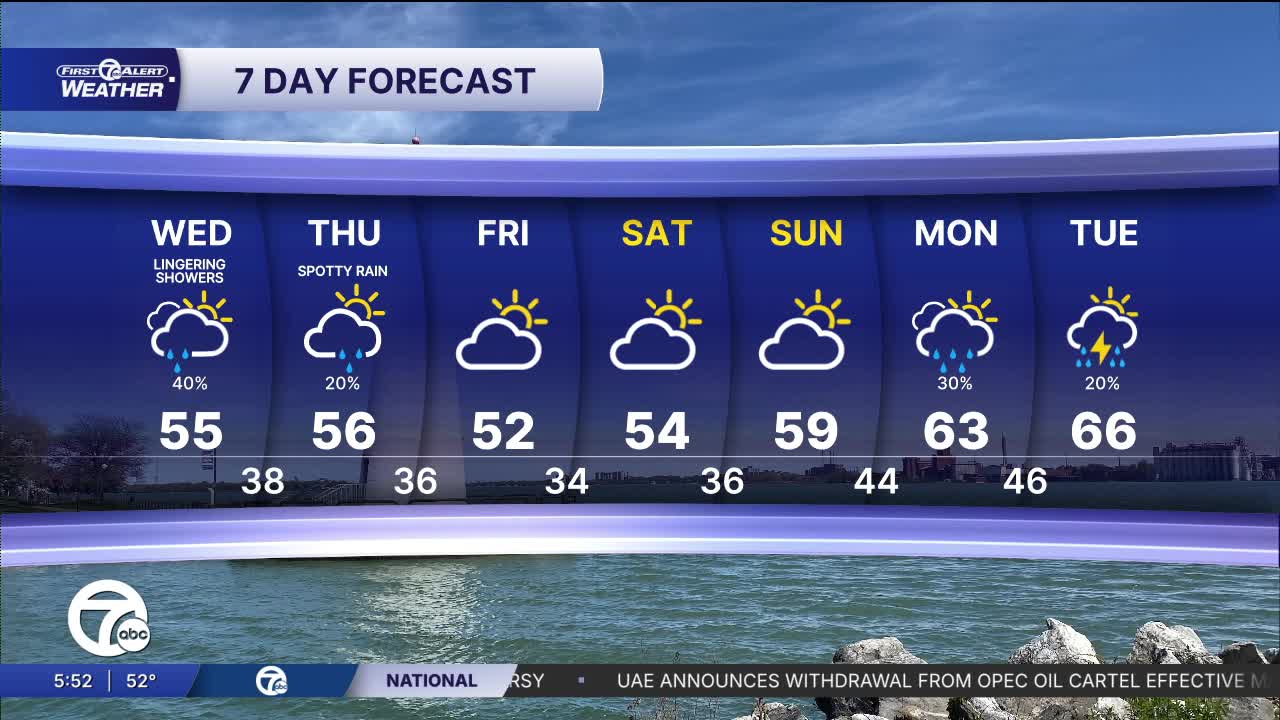


Rain showers return early Wednesday morning and will continue through at least midday. High temperatures will be cool and in the mid 50s.
Watch the forecast below
Cooler air continues into Thursday with morning temperatures in the mid to upper 30s and afternoon highs in the mid 50s. A few showers are possible, otherwise skies will be partly sunny.
Our coldest temperatures happen Friday and Saturday mornings with lows in the low to mid 30s. Frost is possible, so plan to protect any sensitive vegetation. Warmer temperatures return next week.
Wednesday: Scattered showers. Mostly cloudy. Highs will be in the mid 50s. Winds: NNE 5-15 mph.
Thursday: Partly sunny with a few showers possible. Highs in the mid 50s. Winds: WNW 5-15 mph.
Connect with 7 First Alert Meteorologists on Facebook and X:
Facebook: Dave Rexroth , Hally Vogel, Marisa Woloszyn, Mike Taylor
X: Dave Rexroth , Hally Vogel, Marisa Woloszyn, Mike Taylor
Current Conditions
- Humidity: 87%
- Dew point: 72°
- Pressure: 29.95 in
- Wind speed: 3 mph
- Wind direction: S
- Visibility: 10.0 mi
- Sunrise: 05:59 AM
- Sunset: 09:14 PM
