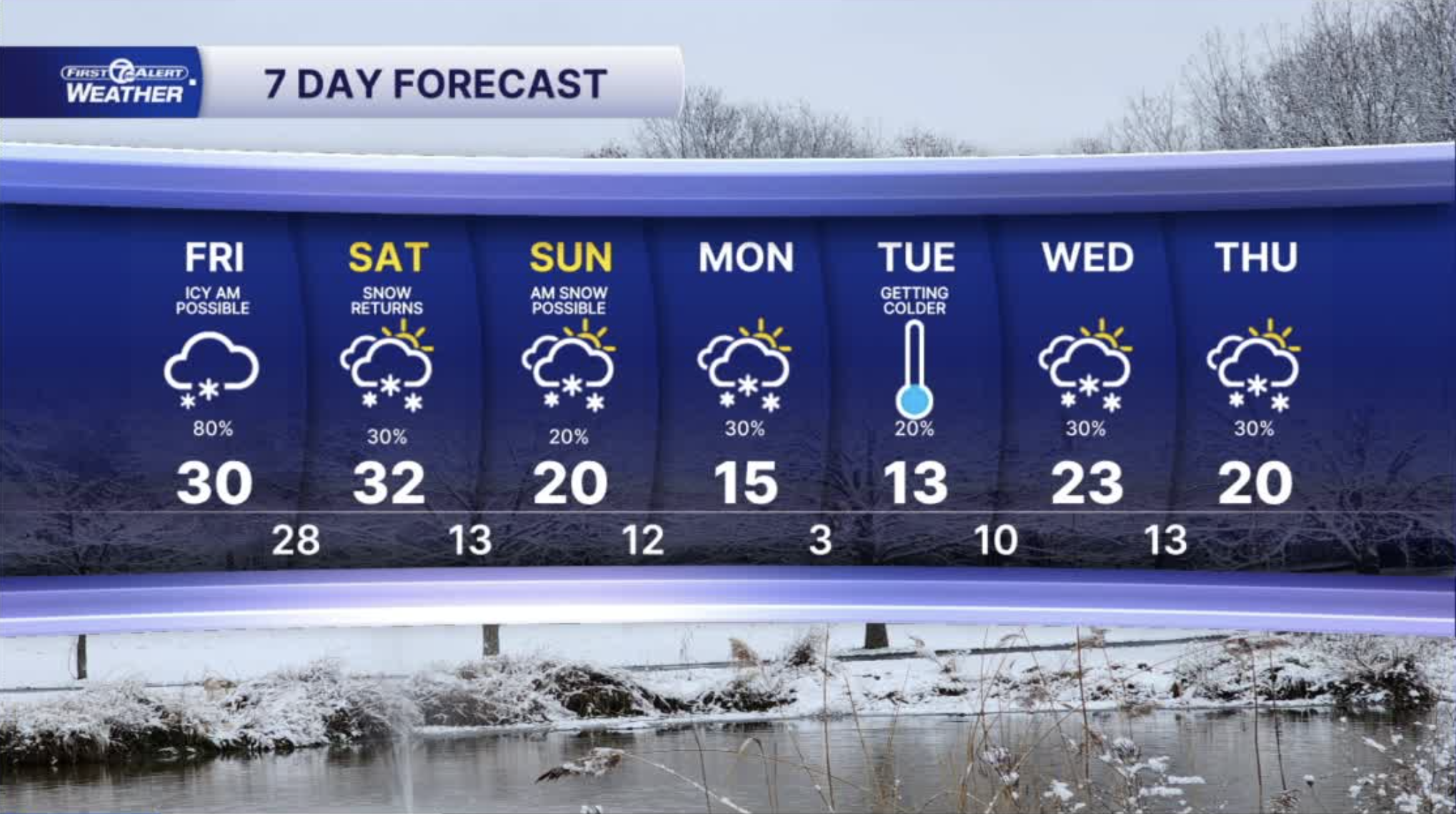


More snow is expected Friday into Friday evening. Widespread totals of 1"-3". Both commutes could be impacted. Friday's temperatures will end up around freezing. That may be the last of normal temperatures for the rest of January!
This weekend stays cold with mostly cloudy skies and chances for Lake effect snow showers. There should be more on Saturday than Sunday.
On Saturday, temperatures temperatures will begin to drop. There won't be much change through the day. This is the start of the coldest air of the season so far. On Sunday it will be a struggle to hit 20° for a high temps and early next week will a tough stretch of very cold temps and wind chills. Monday and Tuesday our wind chills will likely range from 15° to 25° below. It won't be just the early mornings that are so cold. It will be a dangerous stretch including for pets.
Watch the latest forecast in the video player below
Tonight: Increasing clouds with a snow chance toward sunrise. It will be cold with lows in the teens. Winds: SW 5-15 mph.
Friday: More snow with 1"-3" by evening. Both commutes could be impacted. Highs in the low 30s. Winds: SW 15-25 mph.
Saturday: Mostly cloudy with the chance of scattered snow showers. Some minor accumulation is possible. Highs in the mid 20s with temps falling late in the day. Winds: WSW 15-25 mph.
Connect with 7 First Alert Meteorologists on Facebook and X:
Facebook: Dave Rexroth , Hally Vogel, Marisa Woloszyn, Mike Taylor
X: Dave Rexroth , Hally Vogel, Marisa Woloszyn, Mike Taylor
Current Conditions
- Humidity: 39%
- Dew point: 59°
- Pressure: 29.96 in
- Wind speed: 11 mph
- Wind direction: NNW
- Visibility: 10.0 mi
- Sunrise: 06:23 AM
- Sunset: 08:54 PM
