

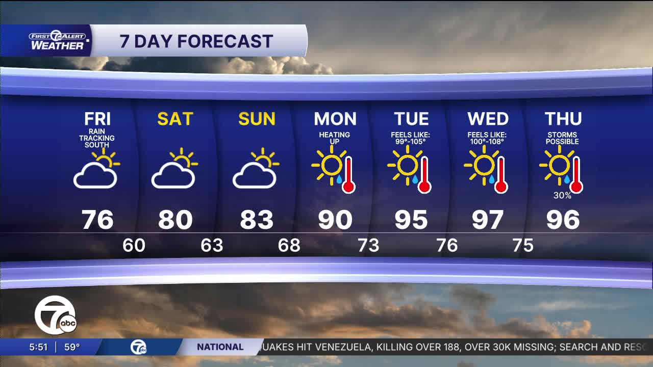


It will be a nice weekend then much hotter next week with highs in the 90s & heat indices soaring past 100 degrees. This starts Monday then really kicks in Tuesday.
Watch the forecast below
A cooler and cloudier pattern settles in for Friday. Temperatures will start in the low 60s during the morning and only recover into the lower to middle 70s during the afternoon. Expect mostly cloudy skies for much of the day, first north and then south in the afternoon. Sunshine will be limited compared to today. If it rains at all it will be south of I-94 with the best chance near the Ohio border late in the day or in the evening.
After a brief cool down on Friday, temperatures rebound through the weekend. Highs return to around 80 on Saturday and the middle 80s by Sunday with a mix of sun and clouds. The real heat arrives early next week as temperatures surge into the 90s Monday through Wednesday. Tuesday through Thursday should be the hottest days of the stretch, with highs in the middle 90s and heat indices climbing well above 100°. A few isolated storms may return by week's end, but the bigger story will be the building heat and humidity.
Tonight: Dry and mostly clear. Lows will be around 60° in Detroit and mid to upper 50s outside the city. Winds: WNW 5-10 mph.
Friday: Partly sunny to at times mostly cloudy with highs in the mid 70s and 76° in Detroit. Winds: SW 5 mph.
Saturday: Partly sunny with a high around 80°. Winds: NE 10 mph.
Connect with 7 First Alert Meteorologists on Facebook and X:
Facebook: Dave Rexroth , Hally Vogel, Marisa Woloszyn, Mike Taylor
X: Dave Rexroth , Hally Vogel, Marisa Woloszyn, Mike Taylor
Current Conditions
- Humidity: 77%
- Dew point: 57°
- Pressure: 30.01 in
- Wind speed: 4 mph
- Wind direction: WNW
- Visibility: 10.0 mi
- Sunrise: 06:33 AM
- Sunset: 08:42 PM
