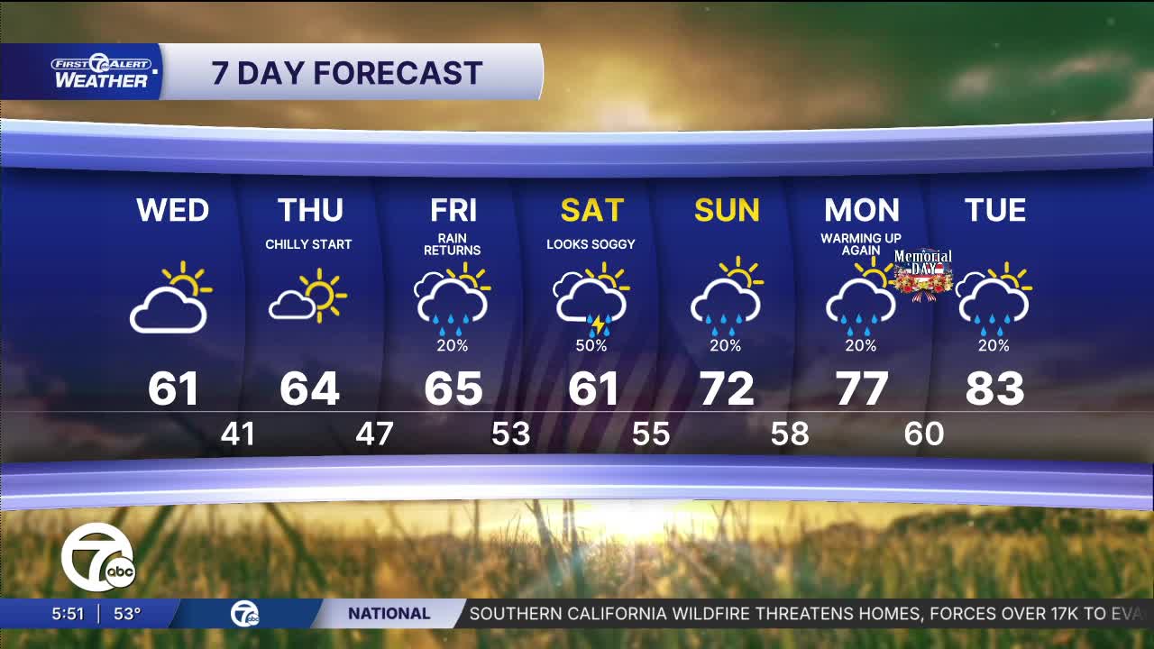


After a few hot, humid, and active weather days, a cold front moved through overnight, bringing cooler and quieter weather. Temperatures start in the low to mid 50s on Wednesday morning and climb into the mid 60s by the afternoon. Skies will be partly to mostly sunny with a much drier breeze from the north and northwest. The cooler than normal weather continues Thursday and Friday. Friday will be our next rain chance. More rain could be around this weekend as temperatures slowly try to warm back up into the 70s for highs.
Watch the forecast below
Tonight: A slight shower chance. With a cold front moving through lows will be in the low to mid 50s. Winds: NW 5-10 mph.
Wednesday: Thickest clouds will be early and then it will get brighter, especially in the afternoon. Highs in the low to mid 60s. Winds: NW 10 mph.
Thursday: Mostly sunny with highs in the mid 60s after a cool start in the 40s. Winds: NE 5-10 mph.
Connect with 7 First Alert Meteorologists on Facebook and X:
Facebook: Dave Rexroth , Hally Vogel, Marisa Woloszyn, Mike Taylor
X: Dave Rexroth , Hally Vogel, Marisa Woloszyn, Mike Taylor
Current Conditions
- Humidity: 87%
- Dew point: 72°
- Pressure: 29.95 in
- Wind speed: 3 mph
- Wind direction: S
- Visibility: 10.0 mi
- Sunrise: 05:59 AM
- Sunset: 09:14 PM
