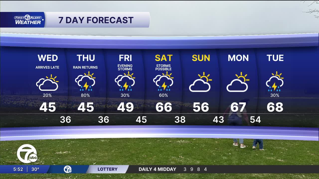


Watch for foggy areas & possible slick spots in the morning. More rain moves in Wednesday night, with thunderstorms are possible Thursday through Saturday. Temps will be warmest Friday & Saturday.
It will be partly to mostly cloudy Wednesday, following areas of fog in the morning. Overall it will be brighter north than south. High temperatures peak in the mid to upper 40s by the late afternoon with the warmest temps on the west side. Rain showers could move in from the south in the evening. Showers continue overnight before more moisture moves in by the late morning Thursday. Rain and and a few thunderstorms are possible Thursday afternoon through the evening. Highs climb Thursday to near 50°.
Another storm system moves in Friday-Saturday, bringing warmer temperatures, more rain, and more chances for thunderstorms.
Watch the forecast below
Tonight: Gradual clearing, then developing fog. Lows in the upper 20s. Winds: Light.
Wednesday: Patchy fog, then mostly cloudy south and partly sunny north. Highs in the mid to upper 40s. Winds: ESE 5-10 mph.
Thursday: Rain is expected with a chance of thunder as well. Highs in the mid to upper 50s. Winds: ENE 5-10 mph.
Connect with 7 First Alert Meteorologists on Facebook and X:
Facebook: Dave Rexroth , Hally Vogel, Marisa Woloszyn, Mike Taylor
X: Dave Rexroth , Hally Vogel, Marisa Woloszyn, Mike Taylor
Current Conditions
- Humidity: 41%
- Dew point: 59°
- Pressure: 29.97 in
- Wind speed: 10 mph
- Wind direction: NNW
- Visibility: 10.0 mi
- Sunrise: 06:23 AM
- Sunset: 08:54 PM
