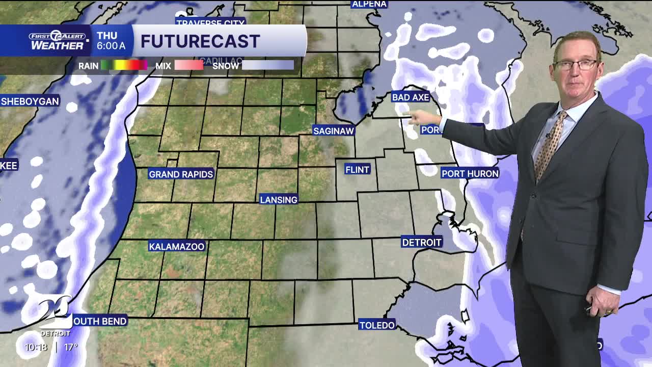


Winter Weather Advisory in Sanilac and Huron counties in the thumb overnight into Thursday morning. 3"-6" of snow is possible there.
Most of the snow ends tonight, but roads are quite slick. Heavy snow is possible in the thumb north of Port Huron overnight with snow off of Lake Huron. Sanilac and Huron counties will end up with 2"-6" by 10 AM Thursday.
It will be a real winter feel for several days to come! There will be many snow chances over the next several days. Temps will drop to near 10° overnight. Wind chills will drop to the single digits below zero by Thursday morning. Expect brighter skies after the first few hours of Thursday with highs near 20° along with brisk northwest winds. Some lake effect snow showers will linger near Lake Huron, but most of us will stay dry. Wind chills will range from just below zero in the morning to barely double digits in the afternoon. Friday will feature snow and wintry conditions once again, especially during the morning into early afternoon, with light snow accumulations possible as colder air is in place after the system earlier in the week. Highs are expected to be around the low 30s with a southerly wind from 10-15 mph and gusts up to 25 mph. This will create decent wind chills again making it feel much colder despite the "slight" warm up. Snow chances taper off Friday evening but more is possible by Saturday morning.
Watch the full forecast
Tonight: A slight chance of snow in Metro Detroit. Heavy snow showers are pssible in Sanilac and Huron counties in the thumb. Slick roads are likely with temps falling to near 10°. Winds: NW 10-20 mph.
Thursday: Clouds early and then partly sunny in Metro Detroit. Along the Huron shoreline a few snow showers may remain in the morning. Very cold with highs struggling to get to 20°. Wind chills will start just below zero and finish barely in the double digits. Winds: NW 10-20 mph.
Friday: Another round of snow possible, especially in the morning, with temps slightly rebounding into the low 30s.
Connect with 7 First Alert Meteorologists on Facebook and X:
Facebook: Dave Rexroth , Hally Vogel, Marisa Woloszyn, Mike Taylor
X: Dave Rexroth , Hally Vogel, Marisa Woloszyn, Mike Taylor
Current Conditions
- Humidity: 39%
- Dew point: 59°
- Pressure: 29.96 in
- Wind speed: 11 mph
- Wind direction: NNW
- Visibility: 10.0 mi
- Sunrise: 06:23 AM
- Sunset: 08:54 PM
