

Think of it this way..... you get two seasons in just one day. Sounds like Michigan weather!
As low pressure sweeps through the region rain could be heavy at times. There could even be some thunder. Temps will continue to rise through the overnight hours to record heights tomorrow morning. They fall for the rest of the day. Rain totals could reach .5"+ where storms are present.
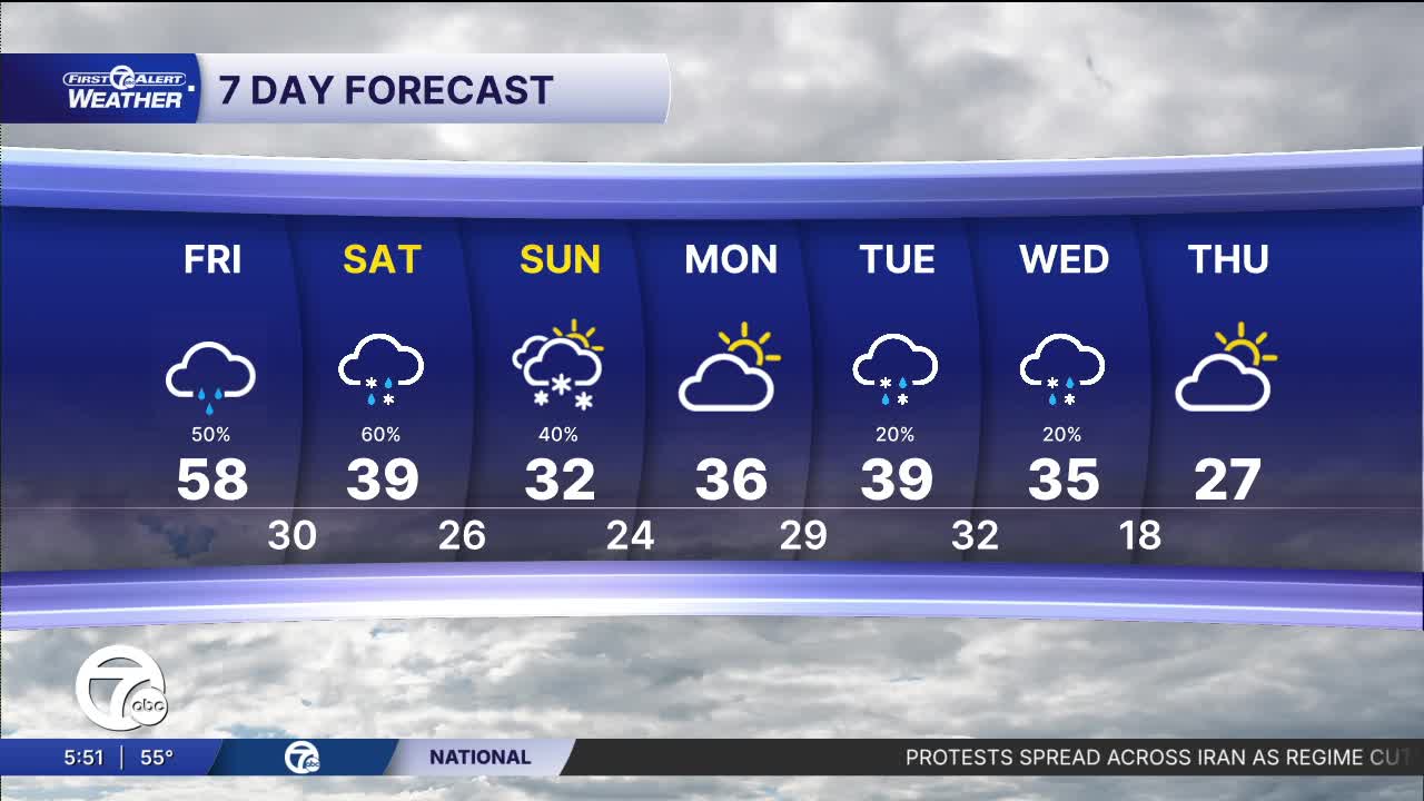
We are expecting record high temps in the morning Friday with 58° in Detroit. The current record is 55° back in 1949. Behind a strong cold front temps will drop from midday through the rest of the day. Temperatures by 5 PM will range from 38° northwest of Detroit to around 45° in the city. Winds will gust to 35 mph Friday as well. In the morning it will be a warm SW wind and then a much colder NW wind in the afternoon.
Watch the full forecast below
Tonight: Rain with some thunder possible. Temps will climb into the 50s by morning. Winds: S 15-25 mph with gusts to 35 mph possible.
Friday: This will be warmest day in a long time with early temps in the 50s a record high in Detroit of 58°, and falling temps into the 40s by late afternoon and 30s Friday night. Winds will turn toward the NW in the afternoon at 15-35 mph behind a cold front.
Saturday: A mix of rain and snow is likely in the afternoon. In Detroit there should be more rain than snow. The higher snow chances are NW of Detroit late in the day. High temps will be in the upper 30s. Winds: E 5-10 mph.
Connect with 7 First Alert Meteorologists on Facebook and X:
Facebook: Dave Rexroth , Hally Vogel, Marisa Woloszyn, Mike Taylor
X: Dave Rexroth , Hally Vogel, Marisa Woloszyn, Mike Taylor
Current Conditions
- Humidity: 37%
- Dew point: 58°
- Pressure: 29.95 in
- Wind speed: 9 mph
- Wind direction: NW
- Visibility: 10.0 mi
- Sunrise: 06:23 AM
- Sunset: 08:54 PM
