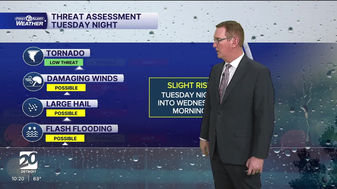


After a new record high temperature today strong to severe thunderstorms are possible Tuesday night through Wednesday morning. Damaging wind, large hail, flooding wind, and a tornado are all possible. Temps will start to fall Wednesday.
Watch the forecast below
Clouds increase tonight as a storm system develops to across the Great Plains and Midwest. This storm system will bring a chance for strong to severe thunderstorms Tuesday night into Wed. morning. Damaging wind gusts, large hail, flooding, and tornadoes are all possible. Plan now for possible severe storms, have a way to receive weather alerts and know where to go to seek shelter.
High temperatures climb into the mid 60s Tuesday ahead of the system, but fall into the low 40s after in moves east. There is a chance for a bit of snow Wednesday night and a rain/snow mix Friday and Sunday. Accumulation will be minimal to none.
Tonight: Clouds increase. Lows in the low to mid 50s. Winds: SSW 10-15 mph.
Tuesday: Mostly cloudy with a chance for showers. Storms are possible late in the day and evening which could be strong to severe. Severe storms are more likely Tuesday night. Highs in the mid to upper 60s.
Wednesday: Heavy rain is likely at times. Storms may be strong in the morning. Highs will be in the mid 50s in Detroit. They will be colder north and warmer south.
Connect with 7 First Alert Meteorologists on Facebook and X:
Facebook: Dave Rexroth , Hally Vogel, Marisa Woloszyn, Mike Taylor
X: Dave Rexroth , Hally Vogel, Marisa Woloszyn, Mike Taylor
Current Conditions
- Humidity: 41%
- Dew point: 59°
- Pressure: 29.97 in
- Wind speed: 10 mph
- Wind direction: NNW
- Visibility: 10.0 mi
- Sunrise: 06:23 AM
- Sunset: 08:54 PM
