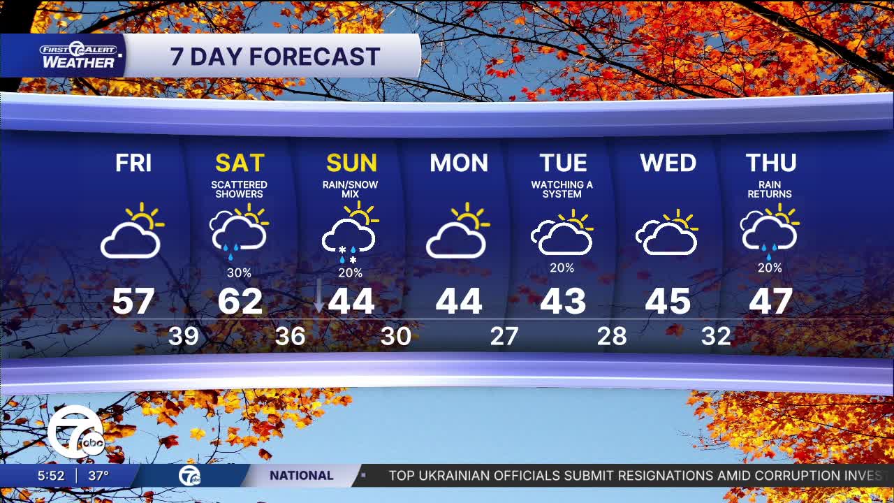


There may be a few morning clouds, but overall it is another bright day Friday. There will be less wind as well, making it feel a little warmer even though temperatures will be similar to Thursday.
As we head into the weekend more clouds will hang around Saturday with a pretty dynamic system coming through. We should get both, a warm front in the morning and then a cold front late in the day. That will pump up our temperatures to around 60° and increase our rain chances Saturday afternoon. Behind the cold front Sunday our highs will be fifteen degrees colder and a cold wind will be back making it feel around 40°. It is likely dry Sunday, but you will be reaching for a warmer coat or jacket again.
Watch the full forecast
Tonight: A few clouds will work in, mostly after midnight. Temps will be close to average dropping into the low 30s with 33° in Detroit. Winds: W 5-10 mph.
Friday: We will finish the week with a few clouds around in the morning and then decent sun in the afternoon. High temperatures will reach the low to mid 50s and 54° in Detroit. Winds: S 5 mph.
Saturday: There will be a lot of clouds and temperatures will jump to the low 60s, including 62° in Detroit. The rain chances will increase in the afternoon. Most of the rain will fall after 4PM through the late evening. Winds: W 10-20 mph.
Connect with 7 First Alert Meteorologists on Facebook and X:
Facebook: Dave Rexroth , Hally Vogel, Marisa Woloszyn, Mike Taylor
X: Dave Rexroth , Hally Vogel, Marisa Woloszyn, Mike Taylor
Current Conditions
- Humidity: 37%
- Dew point: 58°
- Pressure: 29.94 in
- Wind speed: 9 mph
- Wind direction: NNW
- Visibility: 10.0 mi
- Sunrise: 06:23 AM
- Sunset: 08:54 PM
