

AIR QUALITY ALERT FOR ALL OF METRO DETROIT THROUGH MONDAY FOR WILDFIRE SMOKE.
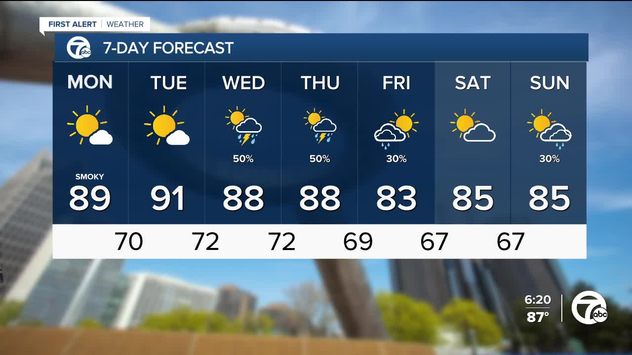
(WXYZ) — Smoke from Canadian wildfires continues to move into southeast Michigan. Air quality was "moderate" to "unhealthy for sensitive groups" for most of Sunday. Air quality will likely becoming "unhealthy" at times Monday, so limit time outside, especially if you have an respiratory illnesses. Aside from the smoke, skies will be mostly sunny with highs in the upper 80s.
Sunshine continues Tuesday with highs peaking in the low 90s.
Storm chances return Wednesday through Friday. High temperatures continue into the mid to upper 80s.
Sunday: Smoky with a slight showers chance. Highs will be in the mid to upper 80s. Winds: WNW 5 - 10 mph
Tonight: Partly cloudy and smoky. Lows in the mid 60s.
Monday: Smoky with highs in the upper 80s, near 90°. Winds: W 5-10 mph
Connect with 7 First Alert Meteorologists on Facebook and X:
Facebook: Dave Rexroth , Hally Vogel, Marisa Woloszyn, Mike Taylor
X: Dave Rexroth , Hally Vogel, Marisa Woloszyn, Mike Taylor
Current Conditions
- Humidity: 44%
- Dew point: 60°
- Pressure: 29.94 in
- Wind speed: 5 mph
- Wind direction: NNW
- Visibility: 10.0 mi
- Sunrise: 06:23 AM
- Sunset: 08:54 PM
