

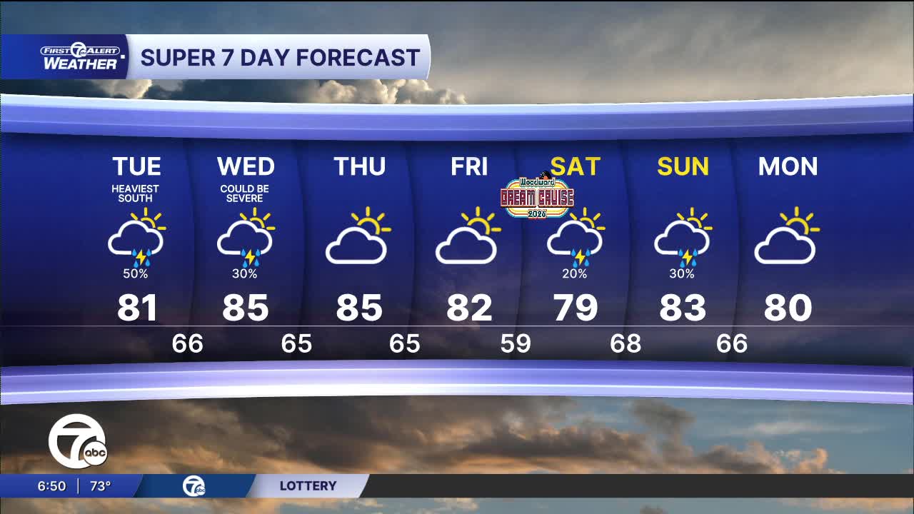


Strong to severe storms are possible again Tuesday afternoon and through the evening. Damaging wind gusts and heavy rain fall are the two biggest concerns again. A few more showers and storms continue into Wednesday before partly sunny skies return for Thursday and Friday. High temperatures will be in the low to mid 80s through the entire week, with lows near 70° early and falling into the low to mid 60s by the end.
See the full forecast in the video below
Tuesday: Partly sunny. Strong to severe storms possible late in the day and through the evening. Highs in the mid 80s as Detroit hits 83°. 82° is average for a high temp this time of year. Winds: Variable 5 mph.
Wednesday: A chance of showers and some storms possible in the afternoon and evening. Highs in the low 80s. Winds: SW 5-10 mph.
Connect with 7 First Alert Meteorologists on Facebook and X:
Facebook: Dave Rexroth , Hally Vogel, Marisa Woloszyn, Mike Taylor
X: Dave Rexroth , Hally Vogel, Marisa Woloszyn, Mike Taylor
Current Conditions
- Humidity: 42%
- Dew point: 46°
- Pressure: 30.34 in
- Wind speed: 10 mph
- Wind direction: E
- Visibility: 10.0 mi
- Sunrise: 07:22 AM
- Sunset: 07:26 PM
