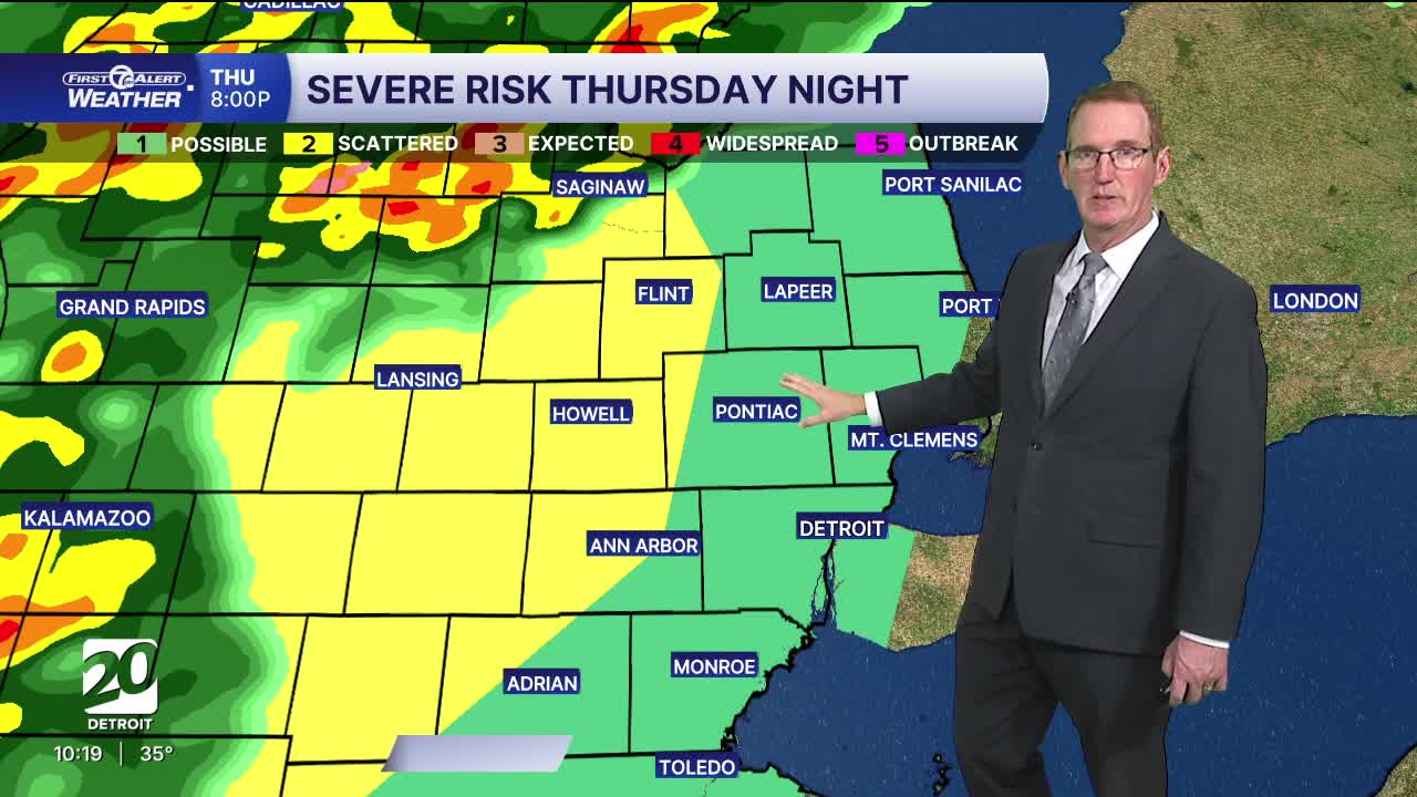


Rain and storms will move through Thursday morning and again in the evening. Heavy rain is expected. Evening storms may be strong to severe moving west to east mostly from 9PM to 2AM.
Watch the forecast below
Tonight rain moves in from the southwest toward morning as temperatures hover in the mid 30s.
Thursday it’s a damp start with morning rain likely and some storms with heavy rain possible. The rain ends in early afternoon. Temperatures climb into the 50s in the afternoon and some will climb into the 60s by evening. Those warmest areas will be around Detroit and to the southwest. There is a low-end threat for high winds, hail, and localized flooding Thursday evening and night.
Friday looks pretty good for the Tigers home opener. There is a very slight shower chance before the game. It should be dry with highs in the low 70s late in the game.
The warmth returns Friday and Saturday with highs in the 70s and then it cools again Sunday with highs in the 40s. The broader pattern turns more active heading into the weekend too, with multiple rounds of showers and storms possible—especially Saturday.
Tonight: Rain closes in again toward morning. Lows near 39° in Detroit. Winds: N 10-15 mph.
Thursday: Rain in the morning with a few storms possible as well. A second round in the evening could be strong to severe. Highs: mid to upper 60s late. Winds: SE 10-20 mph.
Friday: There is a very slight shower chance before the game. It should be dry with highs in the low 70s late in the game. The best sun of the day will be in the afternoon. The high in Detroit will hit 73°
Connect with 7 First Alert Meteorologists on Facebook and X:
Facebook: Dave Rexroth , Hally Vogel, Marisa Woloszyn, Mike Taylor
X: Dave Rexroth , Hally Vogel, Marisa Woloszyn, Mike Taylor
Current Conditions
- Humidity: 87%
- Dew point: 72°
- Pressure: 29.95 in
- Wind speed: 3 mph
- Wind direction: S
- Visibility: 10.0 mi
- Sunrise: 05:59 AM
- Sunset: 09:14 PM
