

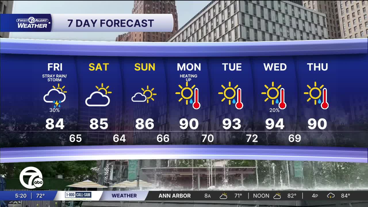


Storms are possible Friday, mainly south of M-59. The weekend should be really nice with sun, dry air, and mid 80s.
Watch the forecast below
Looking ahead, temperatures remain seasonably warm through the weekend with highs mainly in the mid 80s. Rain chances stay away for this weekend and most of next week as heat begins to build early next week. Highs will push toward 90° on Monday and into the lower 90s Tuesday and Wednesday. Thursday will be in the upper 80s and low 90s.
Tonight: Rain and storm chances decrease. Lows will be in the mid to upper 60s. Winds: SW 5 mph.
Friday: Partly sunny with a 30% chance of rain and storms. Most chances will be south of M-59. Highs will be in the mid 80s. Winds: N 5-10 mph.
Saturday: Partly sunny with highs in the mid 80s and 85° in Detroit. Winds: NE 5-10 mph.
Connect with 7 First Alert Meteorologists on Facebook and X:
Facebook: Dave Rexroth , Hally Vogel, Marisa Woloszyn, Mike Taylor
X: Dave Rexroth , Hally Vogel, Marisa Woloszyn, Mike Taylor
Current Conditions
- Humidity: 81%
- Dew point: 49°
- Pressure: 29.97 in
- Wind speed: 10 mph
- Wind direction: W
- Visibility: 10.0 mi
- Sunrise: 06:49 AM
- Sunset: 08:20 PM
