

It will be partly cloudy tonight with a chance of fog. Quieter and drier weather is here through Friday. The rain is back Friday night and Saturday morning and could include storms again.
Watch the full forecast below:
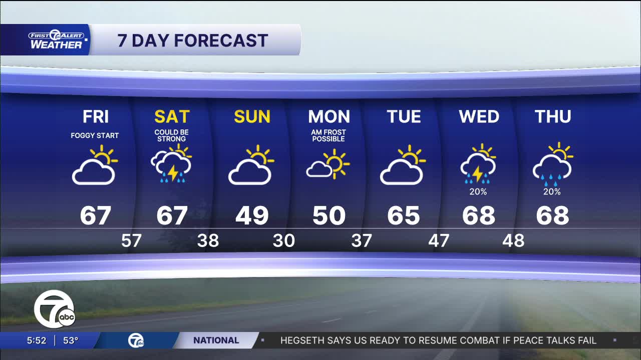
It will be partly cloudy tonight with a chance of fog. Quieter and drier weather is here through Friday. The rain is back Friday night and Saturday morning and could include storms again. Temps tumble behind the front on Sunday with highs only in the 40s.
Tonight: Partly cloudy with a chance of fog and temps in the low to mid 50s. Areas of fog could develop. Winds: N 5 mph.
Friday: Partly sunny with highs in the mid to upper 60s. Winds: SE 5-10 mph.
Saturday: Rain likely in the morning and it could be heavy in some storms. Highs in the mid 60s. Winds: W 15-30 mph.
Connect with 7 First Alert Meteorologists on Facebook and X:
Facebook: Dave Rexroth , Hally Vogel, Marisa Woloszyn, Mike Taylor
X: Dave Rexroth , Hally Vogel, Marisa Woloszyn, Mike Taylor
Current Conditions
- Humidity: 87%
- Dew point: 72°
- Pressure: 29.96 in
- Wind speed: 3 mph
- Wind direction: S
- Visibility: 10.0 mi
- Sunrise: 05:59 AM
- Sunset: 09:14 PM
