

Planning your Day? Check out Weather Planner Plus with Mike Taylor
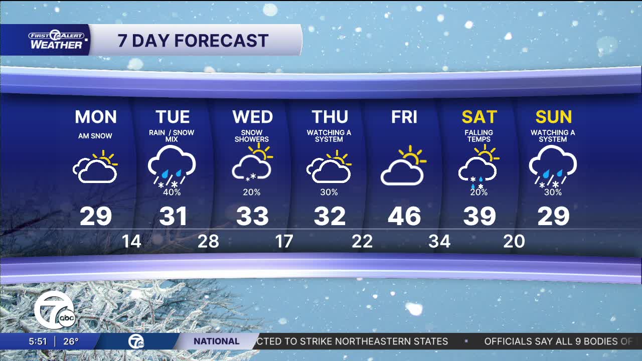
This week starts off chilly with lows near 20° and highs stopping near freezing Monday and Tuesday. Wind chills will be in the teens and 20s both days with mostly cloudy skies.
A winter storm moves across the state Tuesday afternoon into the night. This storm will bring 1-3" of snow across southeast Michigan, with higher amounts north than south.
Another storm moves across Indiana and Ohio Thursday, bringing a good chance for several inches of snow. The amount of snow we see will be highly dependent on the exact track of this winter storm. Stay tuned as we get closer.
See the full forecast in the video below
Tonight: Snow ends late. Mostly cloudy. Lows in the low 20s. Winds: NW 10-20 mph.
Monday: Mostly cloudy. Highs in the upper 20s to low 30s. Winds: NW 15-25 mph.
Tuesday: Mostly cloudy. Snow late. Highs in the low to mid 30s. Winds: SSW 5-15 mph.
Connect with 7 First Alert Meteorologists on Facebook and X:
Facebook: Dave Rexroth , Hally Vogel, Marisa Woloszyn, Mike Taylor
X: Dave Rexroth , Hally Vogel, Marisa Woloszyn, Mike Taylor
Current Conditions
- Humidity: 39%
- Dew point: 59°
- Pressure: 29.96 in
- Wind speed: 11 mph
- Wind direction: NNW
- Visibility: 10.0 mi
- Sunrise: 06:23 AM
- Sunset: 08:54 PM
