


Another winter storm is closing in on metro Detroit with more snow to wrap up the work week. At the time of writing this (10 a.m. Thursday), the Friday morning commute looks okay but snow closes in around lunchtime and picks up from there.

At some point in the evening, the snow is expected to mix with sleet and rain, which will cut down on the snow totals for several locations. The exception will be areas north and west of Detroit since the rain may remain south of these locations.
The snow will not end at this point because the storm will be lifting to the northeast - reinforcing the cold air and igniting the lake effect snow machine. The historically warm lakes will create some intense snow squalls, which may continue even after the storm pulls away.

The Bigger Story
I think the wind will be the bigger issue with this storm even though the snow potential will get the most attention. Wind gusts could reach the upper 40 to 50+ mph range. This could cause power outages in combination with the heavy snow.
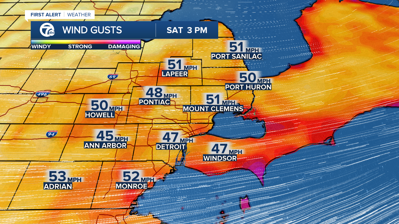

If these winds cause spotty power outages as indicated by our in-house model - this will be bad news with arctic air following the storm.
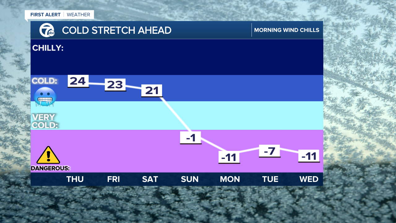
Wind chills will be sub-zero for much of next week.
Detroit weather 7-day forecast
Connect with 7 First Alert Meteorologists!
Facebook: Dave Rexroth, Hally Vogel, Mike Taylor, Marisa Woloszyn
Twitter: Dave Rexroth , Hally Vogel , Mike Taylor, Marisa Woloszyn
