


The Storm Prediction Center (SPC) has placed Metro Detroit under an Enhanced Risk (Level 3) of severe weather tonight. For more on what this means you can visit our Weather Whys (WXYZ) article on the SPC and what their outlooks mean.
Tonight's Outlook Map

This type of outlook is issued when the confidence of having severe weather is high. Therefore, use this time to prepare and have all the necessary provisions for power outages and knowing where you'll take cover in case you're impacted directly.
Timing
Based on the location of the system heading this way the timing for the severe weather will be around 7pm for our western & southwestern viewing areas; such as Adrian, Ann Arbor, Dexter and Howell.
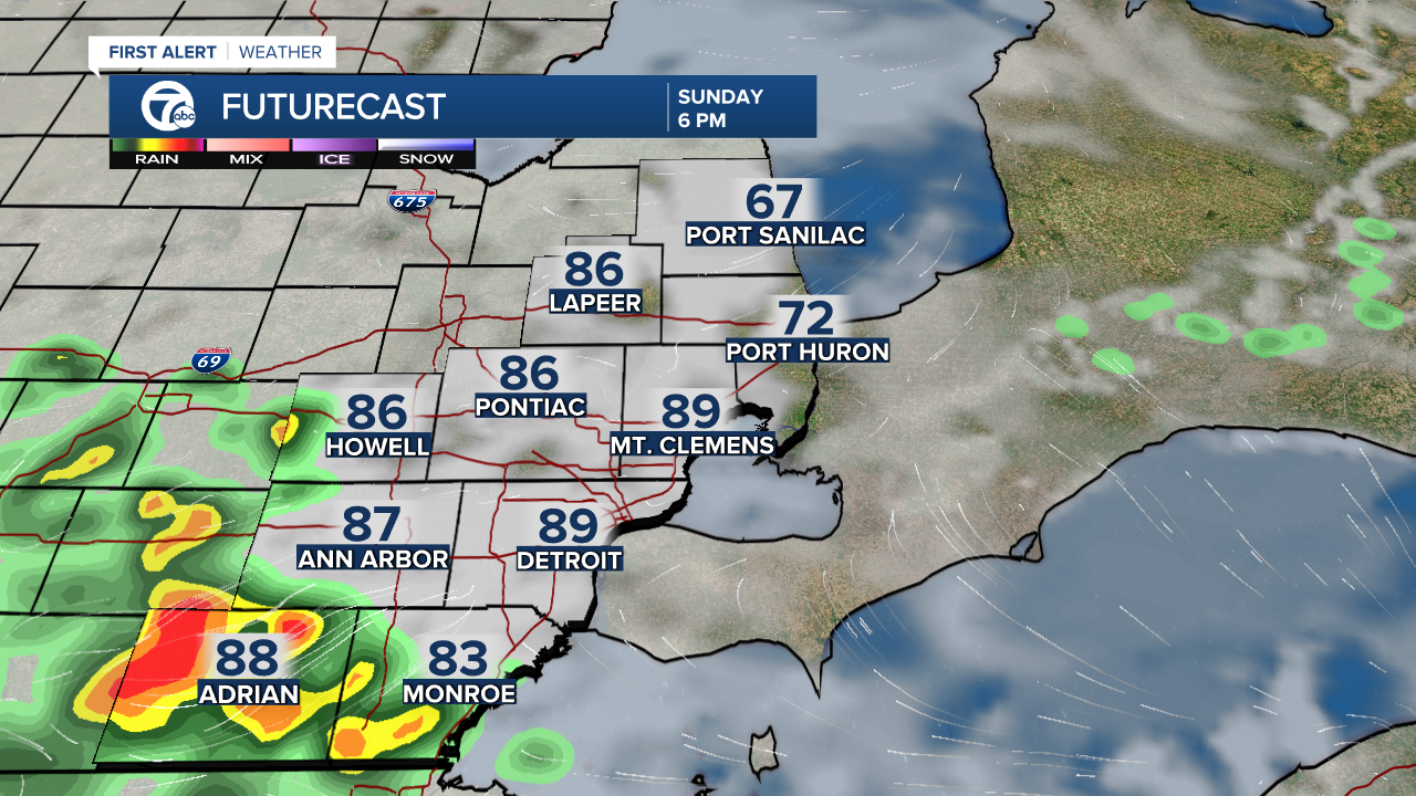
From 8pm to 9pm this line will approach areas near central and western Wayne County like the Canton/Plymouth area, Belleville and Inkster - extending all the way up to M-59 near Pontiac.
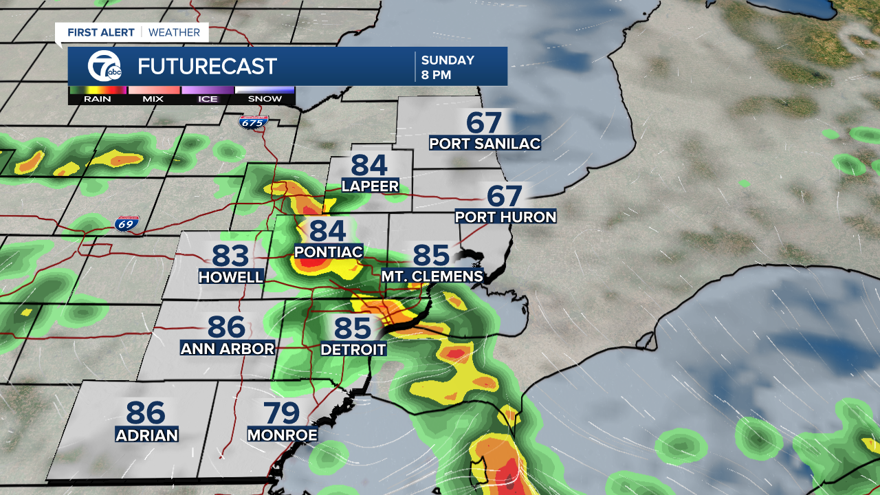
The second part of this forecast is tricky since it is based on speed and position of the system. If a secondary line forms bringing a damaging wind threat behind the initial storms along the warm front, severe weather could last well into the night as late as 3 am. If this is the case, it will definitely be wise to have a way to get warnings since most of us are sleep during that time.
The primary threat is damaging winds, which is usually the case in Michigan. Other threats are just as possible tonight however from Flash Flooding to possible tornadoes.

Stay alert and be safe!
Detroit weather 7-day forecast
Connect with 7 First Alert Meteorologists on Facebook and Twitter:
Facebook: Dave Rexroth , Hally Vogel , Kevin Jeanes , Mike Taylor
Twitter: Dave Rexroth , Hally Vogel , Kevin Jeanes , Mike Taylor
