


Punxsutawney Phil saw his shadow Tuesday morning meaning 6 more weeks of Winter and that's bad news considering what's ahead. So far our Michigan Winter has been fairly mild but change is on the way. As we make the transition into February we'll be facing a reinforcement of arctic air and snow to remind us all there's still a lot of Winter left. Here's a look at the stats for the month.

Return of the Cold & Snow
Thursday will bring another round snow, which could mix with rain and sleet as well. We are still a couple days out but models have convincingly shown a storm heading towards the Great Lakes with an arctic air-mass following right behind it. Even though "snow" and "storm" are buzzwords, I believe the arctic air behind this system will be the bigger story heading into next week.
The timing of this storm appears to be Thursday night - Friday morning. Stay connected with us for details on how much snow we'll see.

Did you say Arctic Air?!
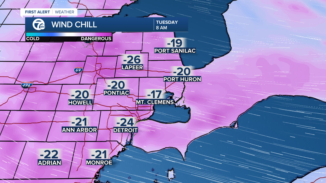
That's right and it'll be cold enough to hear term "Polar Vortex" being thrown around again on national news. Temps will be below average by roughly 10° - 20° placing highs in the teens with sub-zero wind chills.
Detroit weather 7-day forecast
Connect with 7 First Alert Meteorologists on Facebook and Twitter:
Facebook: Dave Rexroth , Hally Vogel , Kevin Jeanes , Mike Taylor
Twitter: Dave Rexroth , Hally Vogel , Kevin Jeanes , Mike Taylor
