

Snow showers wrap up tonight, leading to partly cloudy skies and lows near 0°. Wind chills will be -10° to -15°.
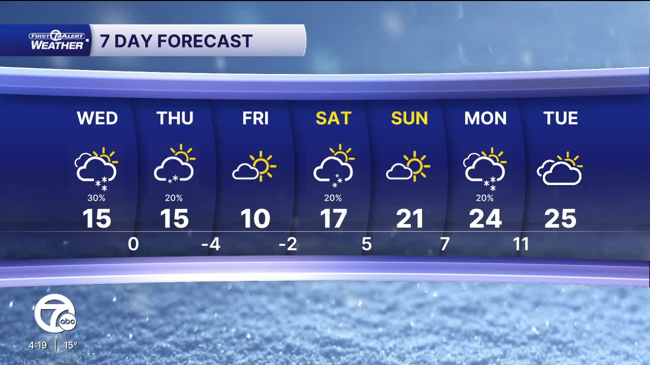
Wednesday remains very cold but a bit calmer after Tuesday’s snow chances, with partly sunny skies and highs in the mid teens. Wednesday night turns mostly cloudy with temperatures dropping back toward around 0°, and wind chills -10° to -15°.
Thursday will be very cold with partly sunny skies. Highs peak in the mid teens. A snow showers or flurries can't be ruled out.
The coldest air arrives Thursday night and into Friday morning. Clear skies Thursday night will allow temperatures to fall to -5° to -10° Friday morning. Wind chills will be -20° to -25°. Clear skies continue during the day Friday, with sunshine and highs near 10°.
Warmer weather arrives this weekend with highs climbing into the 20s starting Sunday.
Check out the forecast:
Tonight: A few passing clouds with lows near 3°. Winds: W 10-15 mph.
Wednesday: Mostly cloudy with a slight chance for snow. Highs in the mid-teens. Winds: SW 5-15 G20 mph.
Connect with 7 First Alert Meteorologists on Facebook and X:
Facebook: Dave Rexroth , Hally Vogel, Marisa Woloszyn, Mike Taylor
X: Dave Rexroth , Hally Vogel, Marisa Woloszyn, Mike Taylor
Current Conditions
- Humidity: 39%
- Dew point: 59°
- Pressure: 29.96 in
- Wind speed: 11 mph
- Wind direction: NNW
- Visibility: 10.0 mi
- Sunrise: 06:23 AM
- Sunset: 08:54 PM
