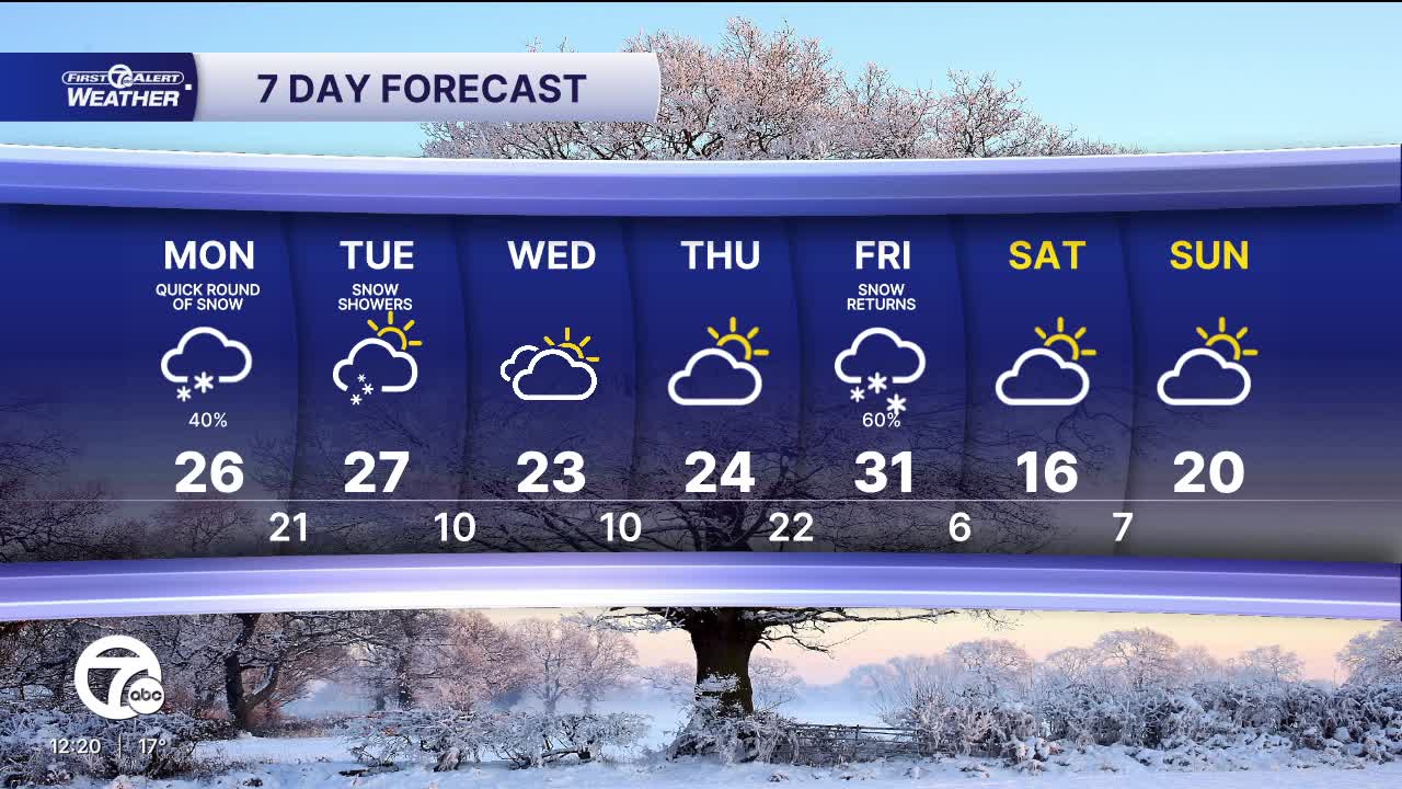


After some sunshine and return to the 20s, after 10 days, across Metro Detroit, clouds return with snow showers into the workweek. An Alberta clipper will bring some light snow after 7 a.m. across Metro Detroit, with snow moving west to east. Snow showers will be most widespread between 7-11 a.m. with isolated snow showers continuing through the early evening. Temperatures will start in the single digits, with wind chills just below zero, and highs climb back into the mid 20s.
We keep temperatures in the 20s for midweek, with mostly cloudy to partly sunny skies.
Another chance for accumulating snow arrives with a storm system Thursday night and into Friday.
Check out the forecast:
Tonight: Clouds increase. Lows in the mid single digits. Wind chills near -5°. Winds SW 5 mph.
Monday: Light snow showers. Accumulation less than 1". Highs in the mid 20s. Winds: SSW 5-10 mph.
Tuesday: Mostly cloudy. Highs in the mid 20s. Winds: W 5 mph.
Connect with 7 First Alert Meteorologists on Facebook and X:
Facebook: Dave Rexroth , Hally Vogel, Marisa Woloszyn, Mike Taylor
X: Dave Rexroth , Hally Vogel, Marisa Woloszyn, Mike Taylor
Current Conditions
- Humidity: 39%
- Dew point: 59°
- Pressure: 29.96 in
- Wind speed: 11 mph
- Wind direction: NNW
- Visibility: 10.0 mi
- Sunrise: 06:23 AM
- Sunset: 08:54 PM
