

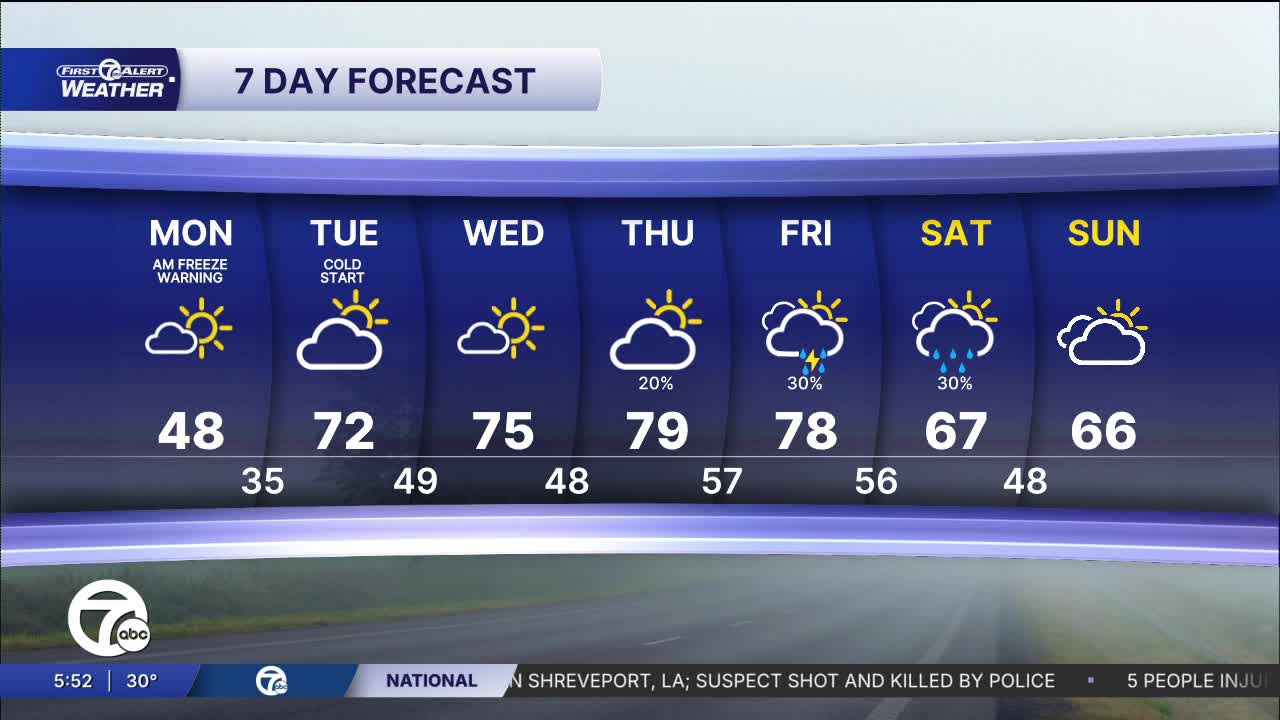


A Freeze Warning is in effect from 11 p.m. tonight until 11 a.m. Monday morning for southeast Michigan. Sub-freezing temperatures could kill crops or sensitive vegetation. Damage to outdoor plumbing is also possible.
Showers wind down Sunday night, leading to clearing skies and colder temperatures by Monday morning. Temperatures start in the mid to upper 20s with widespread frost likely. Mostly sunny skies will help temperatures climb into the upper 40s by the afternoon.
Temperatures continue to climb through the rest of the week, with upper 60s return Tuesday, and 70s by Thursday. Some light rain is expected Tuesday night, but otherwise we stay dry until Friday.
Watch the full forecast in the video below:
Tonight: Clearing skies. Freeze Warning. Lows in the mid to upper 20s. Winds: NNW 5-10 mph.
Monday: AM frost. Mostly sunny. Highs in the upper 40s. Winds: NW 5-10 mph.
Tuesday: Partly sunny. Highs in the mid to upper 60s.
Connect with 7 First Alert Meteorologists on Facebook and X:
Facebook: Dave Rexroth , Hally Vogel, Marisa Woloszyn, Mike Taylor
X: Dave Rexroth , Hally Vogel, Marisa Woloszyn, Mike Taylor
Current Conditions
- Humidity: 89%
- Dew point: 72°
- Pressure: 29.95 in
- Wind speed: 3 mph
- Wind direction: SSW
- Visibility: 10.0 mi
- Sunrise: 05:59 AM
- Sunset: 09:14 PM
