

Watch the forecast below
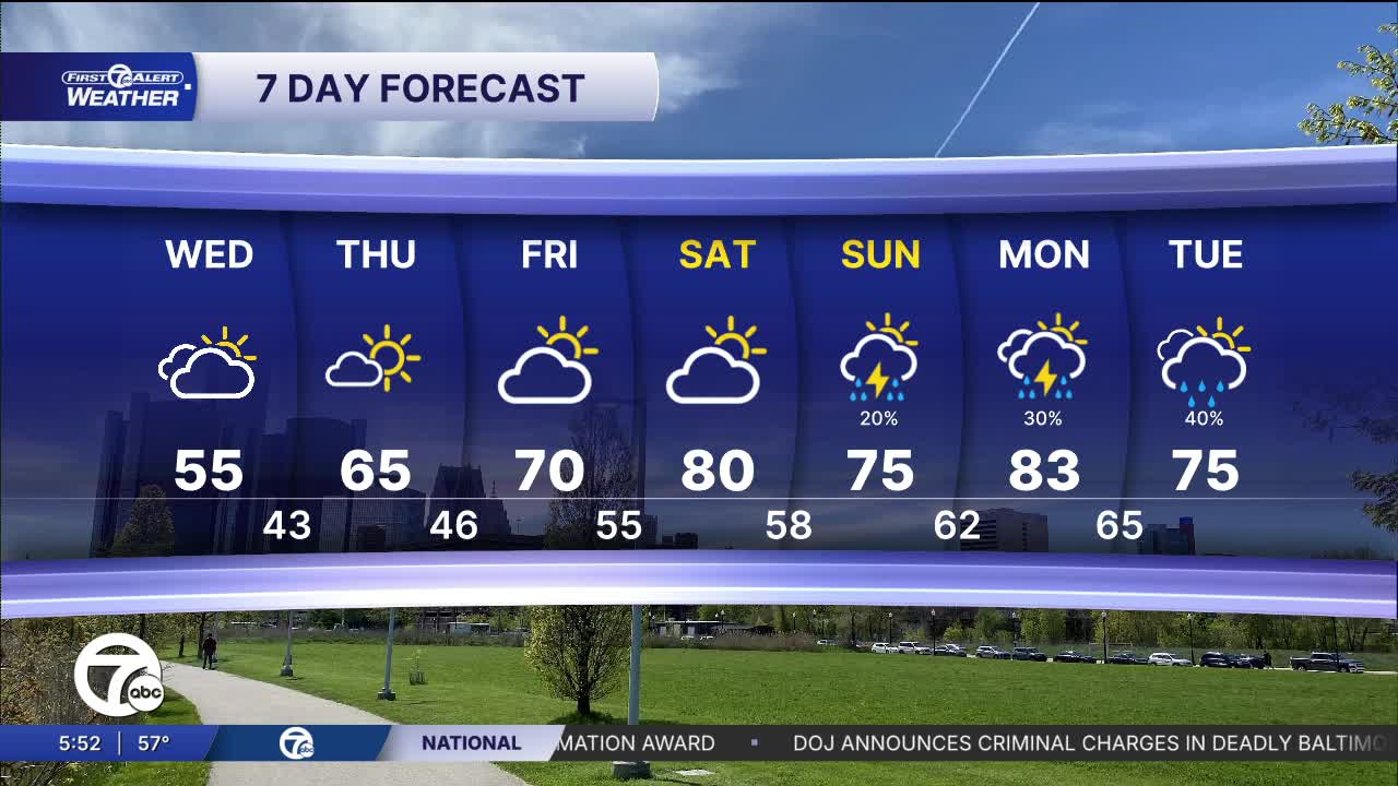
There won't be much sun Wednesday. That will keep us cool again. This weekend brings big heat!
Wednesday looks cool and mostly cloudy. The first few hours of the day we may get some sun. Temperatures will struggle through the 50s for much of the day. A few sprinkles are possible in the afternoon. The brisk wind will keep the cool feel around.
Temperatures begin climbing Friday. Highs may flirt with 70° in a few spots. Warmer air builds in Saturday and Sunday with highs climbing into the upper 70s to 80°. Monday should be in the low 80s for many of us with some storms possible.
Tonight: Showers and storms likely until around 2 AM. Severe weather is not expected. Not as cold with lows in the upper 40s and low 50s. Winds: SW 15-25 mph.
Wednesday: Mostly cloudy with a few sprinkles possible in the afternoon. Highs in the mid to upper 50s. Winds: WNW 15-25 mph.
Thursday: Partly to mostly sunny with highs in the low 60s. Winds N 10-20 mph.
Connect with 7 First Alert Meteorologists on Facebook and X:
Facebook: Dave Rexroth , Hally Vogel, Marisa Woloszyn, Mike Taylor
X: Dave Rexroth , Hally Vogel, Marisa Woloszyn, Mike Taylor
Current Conditions
- Humidity: 87%
- Dew point: 72°
- Pressure: 29.95 in
- Wind speed: 3 mph
- Wind direction: S
- Visibility: 10.0 mi
- Sunrise: 05:59 AM
- Sunset: 09:14 PM
