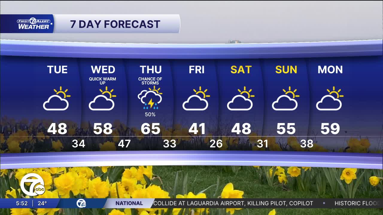


Yes, it is much colder than it should be. The average high should be closer to 50° than 30°. With mostly clear skies and light winds we will drop into the 20s overnight. Temps build form the 40s to 60s through Thursday. Rain is expected Thursday and late Thursday there could be storms.
See the latest forecast in the video below
Clearing skies will settle in tonight allowing temperatures to drop into the upper teens to low 20s—around 26° in Detroit. Winds will get lighter overnight. With diminishing cloud cover it will feel noticeably colder in the early hours of Tuesday.
Temperatures will climb steadily into the mid to upper 40s by late Tuesday afternoon. Skies will be partly to mostly cloudy with a bit more sun in the morning compared to the afternoon. A noticeable warm-up arrives midweek before temperatures trend cooler again heading into the weekend. Wednesday looks mild with highs near 58°, followed by the warmest day of the week Thursday around 65° and a chance of storms late in the day. Cooler air returns Friday with highs dropping into the low 40s, then moderating slightly into the weekend with upper 40s Saturday and 50s Sunday.
Tonight: Clearing skies around with lows in the low 20s, but 26° in Detroit. Winds: Light
Tuesday: Partly cloudy skies during the morning with clouds building in the afternoon. Highs near 48°. Winds: SW 5-10 mph.
Wednesday: Warmer with partly sunny skies and highs in the mid to upper 50s. Winds: S 10 mph.
Connect with 7 First Alert Meteorologists on Facebook and X:
Facebook: Dave Rexroth , Hally Vogel, Marisa Woloszyn, Mike Taylor
X: Dave Rexroth , Hally Vogel, Marisa Woloszyn, Mike Taylor
Current Conditions
- Humidity: 41%
- Dew point: 59°
- Pressure: 29.97 in
- Wind speed: 10 mph
- Wind direction: N
- Visibility: 10.0 mi
- Sunrise: 06:23 AM
- Sunset: 08:54 PM
