

A Wind Advisory is in effect for all of southeast Michigan until 12 a.m. Tuesday. Winds will be south tonight, then switching to the west 20-30 mph, with gusts 45 mph.
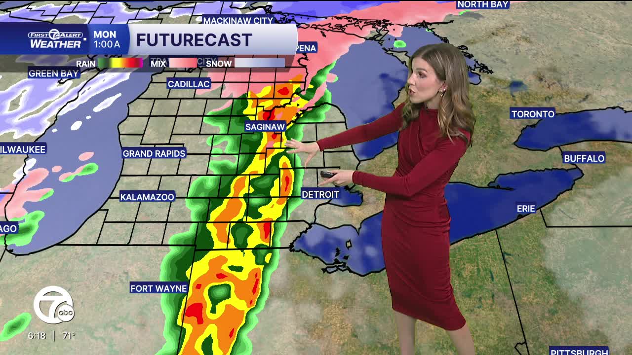
A cold front pushes through after midnight Sunday night, bringing the potential for strong to severe storms across the area. The main concern is strong winds with gusts 60+ mph. An isolated tornado is possible, but the threat is low. Plan now for ways to receive weather alerts, especially between 12-3 a.m. Monday.
Cold air pushes in Monday, dropping temperatures into the mid 30s throughout the day. Snow showers pick up during the afternoon, with snow squalls (narrow bands of intense snowfall that reduce visibility to less than 1/4 mile) possible.
Temperatures bottom out in the mid teens Tuesday morning with wind chills near 0°. Highs climb into the upper 20s by the afternoon with mostly cloudy skies and a spotty snow showers.
Temperatures climb the second half of the week as a series of weak storms slide in from the northwest.
Check out the forecast:
Tonight: Strong to severe storms possible between 12-3 a.m. Temps in the upper 40s by sunrise. Winds: S/W 20-30 G45 mph.
Monday: Mostly cloudy, increasing snow showers. Accumulation: <1/2". Temps fall to near 30° by the late afternoon. Winds: W 20-25 G45 mph.
Tuesday: Partly sunny, spotty snow showers. Highs in the upper 20s. Winds: NW 15 G25 mph.
Connect with 7 First Alert Meteorologists on Facebook and X:
Facebook: Dave Rexroth , Hally Vogel, Marisa Woloszyn, Mike Taylor
X: Dave Rexroth , Hally Vogel, Marisa Woloszyn, Mike Taylor
Current Conditions
- Humidity: 41%
- Dew point: 59°
- Pressure: 29.97 in
- Wind speed: 10 mph
- Wind direction: N
- Visibility: 10.0 mi
- Sunrise: 06:23 AM
- Sunset: 08:54 PM
