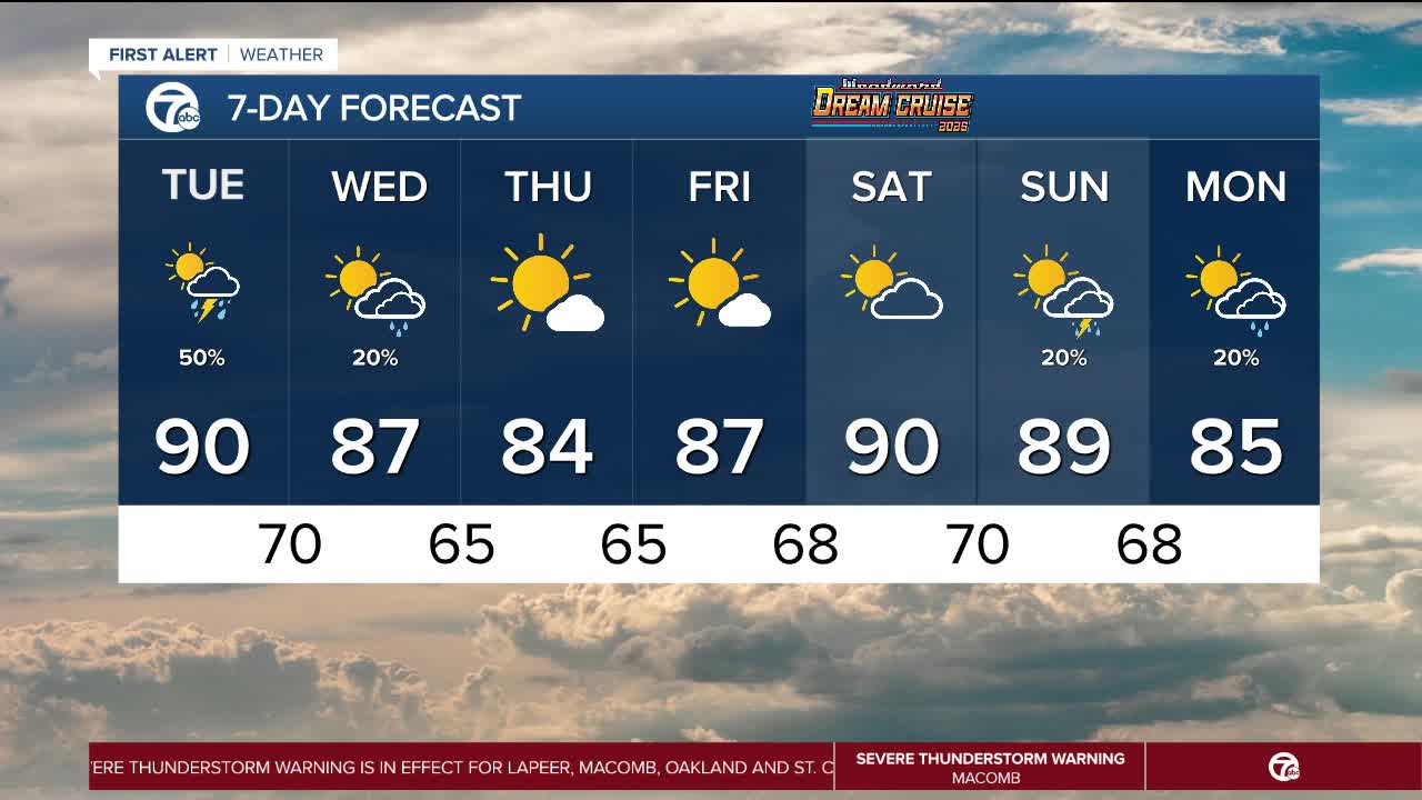


Another hot and humid day is on tap for Tuesday. Temperatures will start near 70° in the morning and climb to near 90° in the early afternoon. Showers and storms will develop across Southeast Michigan, mainly after 2 p.m. Scattered showers and storms will continue through early Tuesday night, mainly ending around midnight. A few storms may be strong to severe, with damaging wind gusts and heavy downpours leading to localized flooding possible.
The full forecast
Tonight: Partly cloudy with lows near 70°. Winds: S 5-10 mph.
Tuesday: Partly sunny with showers and thunderstorms likely. Some storms could be strong to severe. Highs near 90°. Winds: SW 5-15 mph.
Wednesday: Partly sunny with a slight chance for a shower. Highs in the upper 80s. Winds: W 5-10 mph.
Current Conditions
- Humidity: 40%
- Dew point: 59°
- Pressure: 29.94 in
- Wind speed: 9 mph
- Wind direction: NNW
- Visibility: 10.0 mi
- Sunrise: 06:23 AM
- Sunset: 08:54 PM
