

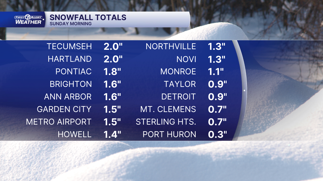
(WXYZ) — Sunday snowfall across Metro Detroit was a trace to 2". Check out the totals below:
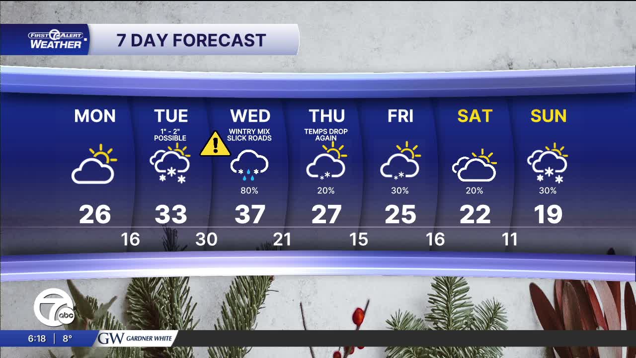
The workweek start off cold with morning temperatures in the teens. Highs climb into the mid 20s under partly sunny skies.
Our next round of accumulating snow arrives Tuesday morning. Snow will start around 6 a.m. and continue through 1 p.m. The latest snowfall outlook will bring around 1" to Metro Detroit, with higher amounts possible north of I-69. High temperatures peak in the low to mid 30s. Winds will be out of the southwest 15-25 mph.
Another system quickly moves in Tuesday night. This system will track right across southeast Michigan, splitting the area in half. The northern half can expect accumulating snowfall Tuesday night into Wednesday. The southern half can expect snow and rain showers, with little to no accumulation.
Check out the forecast:
Monday: Partly sunny. Highs in the mid 20s. Winds: ENE 5 mph.
Connect with 7 First Alert Meteorologists on Facebook and X:
Facebook: Dave Rexroth , Hally Vogel, Marisa Woloszyn, Mike Taylor
X: Dave Rexroth , Hally Vogel, Marisa Woloszyn, Mike Taylor
Current Conditions
- Humidity: 37%
- Dew point: 58°
- Pressure: 29.95 in
- Wind speed: 9 mph
- Wind direction: NW
- Visibility: 10.0 mi
- Sunrise: 06:23 AM
- Sunset: 08:54 PM
